

The strong wind signal No 3 will remain in force at least until 9 am on Saturday as severe tropical storm Mitag has made landfall near Guangdong province's Shanwei in the afternoon.
"Mitag is expected to edge closer to the vicinity of the Pearl River Estuary tonight (Friday night) and tomorrow (Saturday) morning and weaken gradually, skirting around 100 kilometers to the north of Hong Kong," the Hong Kong Observatory said in a bulletin.
At 4 pm, Mitag was estimated to be about 120 kilometers east-northeast of Hong Kong and to move northwest at about 10 km per hour towards the vicinity of the Pearl River Estuary, according to the city's weather forecaster.
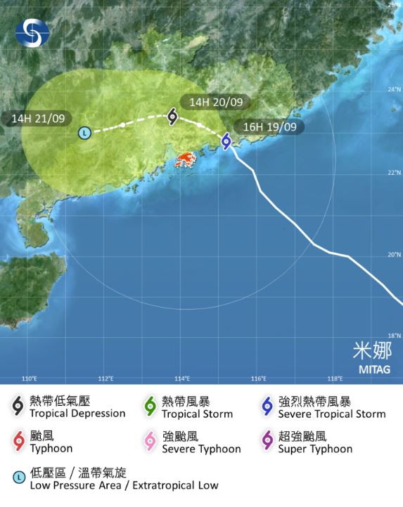
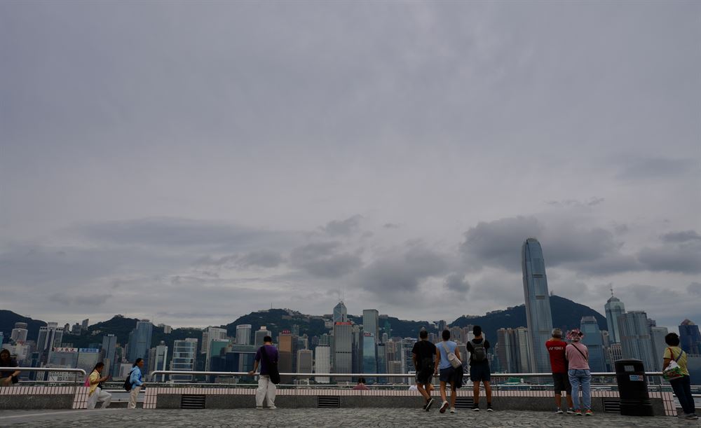
"Strong winds are prevailing generally over Hong Kong. The outer rainbands of Mitag are bringing squally showers to the vicinity of the Pearl River Estuary," the observatory said.
Unless Mitag adopted a track closer to Hong Kong and maintained a higher intensity, the chance of issuing higher tropical cyclone warning signals was relatively low, the HKO stressed.
ALSO READ: Tropical cyclone Mitag: T1 signal to remain in force until Friday in HK
The Education Board has announced that classes of kindergartens, schools for children with physical disability and schools for children with intellectual disability were suspended on the day.
With Mitag departing, winds will weaken on Sunday but still showery and it will be very hot early next week.
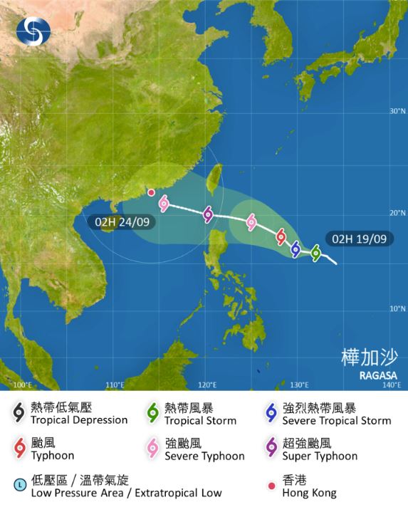
Tropical cyclone Ragasa
Meanwhile, the HKO warned that the weather will deteriorate significantly midweek next week, as another tropical cyclone, Ragasa, over the western North Pacific to the east of the Philippines was expected to enter the northern part of the South China Sea early next week, edging closer to the coast of southern China.
“According to the present forecast, tropical cyclone Ragasa will intensify significantly and move towards the vicinity of Luzon Strait in the next few days, and it may reach super typhoon intensity,” the observatory said on Friday.
Under the influence of its broad circulation, winds will strengthen again midweek next week, with heavy squally showers, thunderstorms and storm surge, the city’s weather forecaster added.