
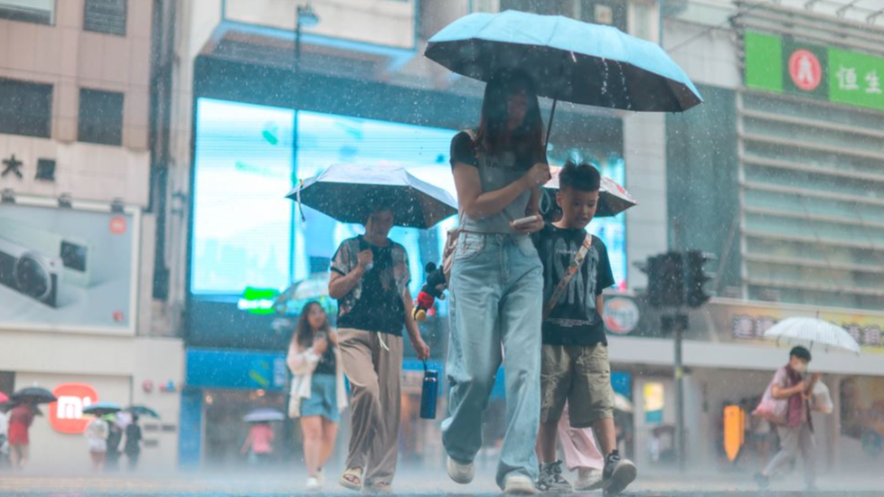
Hong Kong was much wetter than usual in August as heavy rain associated with an active southwest monsoon and a number of tropical cyclones pounded the city, triggering a record of four black rainstorm warnings, the Hong Kong Observatory said Tuesday.
The monthly rainfall recorded at the observatory was 939.2 millimeters, more than double the August normal of 453.2 millimeters, and the third highest on record for the month, the HKO said in a statement.
On Aug 5, the observatory registered a record-breaking daily rainfall of 368.9 millimeters, the highest daily rainfall in August since records began in 1884, it added.
ALSO READ: Record deluge swamps HK: Rainstorm alert downgraded to amber
Although the first half of the year was much drier than usual, the observatory said that, with outbreaks of heavy rain in July and August, the accumulated rainfall in the first eight months of the year was 1 985.3 millimeters, approximating the normal value of 1 921.5 millimeters for the same period.
The observatory also said that last month was much cloudier than usual, with the mean amount of cloud for the month at 81 percent, 11 percent above the normal of 70 percent, and one of the fourth highest on record for August.
While the monthly mean temperature of 29.0 degrees Celsius was only 0.3 degrees above the normal, together with higher than normal temperatures in June and July, summer this year from June to August was hotter than normal, the HKO said.
The mean minimum temperature of 27.2°C
ALSO READ: HK cancels all alerts after year’s second black rainstorm warning
Under the influence of a southwesterly airstream, the weather of Hong Kong was very hot with sunny periods on the first day of August.
There were also heavy showers and thunderstorms in some areas in the afternoon with more than 70 millimeters of rainfall recorded over the North District.
An active southwest monsoon and upper-air disturbances brought heavy showers and squally thunderstorms to the coast of Guangdong from Aug 2 to 5. The outbreaks of heavy showers led to the black rainstorm warning being issued thrice in just four days, the HKO said.
The record daily rainfall of 468.9 millimeters on Aug 5 was already more than 80 percent of the normal rainfall for August, it added.
ALSO READ: HK cancels T1 signal, issues amber rainstorm alert as Podul departs
Then again on Aug 14, more than 100 millimeters of rainfall were recorded over many places in the territory, with rainfall exceeding 200 millimeters over Lantau Island, Tuen Mun and parts of Hong Kong Island.
Record black rainstorm warnings
The incessant downpour led to the issuance of the fifth black rainstorm warning this year, breaking the previous record of three set in 2000 and 2006 since the start of the rainstorm system operation in 1992, the HKO said.
On Aug 28, Nongfa formed as a tropical depression over the central part of the South China Sea and moved northwestwards to the general direction of the seas south of Hainan Island.
Record T1 signal
The Standby Signal, No. 1 was issued that night, for the eighth time this year, breaking the highest record between January and August since 1946, the HKO said.
Nongfa intensified into a tropical storm and tracked across the seas south of Hainan on Aug 30. It made landfall over central and northern Vietnam that afternoon and then weakened into a tropical depression.