
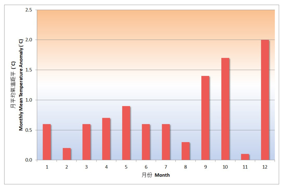
With all 12 months warmer than usual, including the record-breaking monthly mean temperature in October, 2025 was the sixth warmest year on record for Hong Kong.
Globally, the year is on track to be the second or third warmest year on record, according to the World Meteorological Organization's preliminary assessment. Over the Arctic and Antarctica, sea-ice extent remained well below average during the year.
According to the Hong Kong Observatory (HKO), the annual mean temperature reached 24.3 degrees in the city last year, 0.8 degrees above the 1991-2020 normal.
The annual mean maximum temperature of 27.1 degrees Celsius and the annual mean minimum temperature of 22.4 degrees Celsius were the fifth-highest and sixth-highest, respectively, since records began in 1884.
RELATED ARTICLES
- HK records coldest day so far this winter
- HK wakes up to nippy weather as Tai Mo Shan logs 2.4°C
- Temperatures top 37 degrees in parts of Hong Kong
- This autumn's chilliest day for HK as mercury drops to 18.4 C
- Observatory: Hong Kong’s October exceptionally warm
The lowest temperature, recorded at the observatory on Jan 27 last year, was 10.6 degrees Celsius. There were six cold days, 9.2 days less than the normal for the 1991-2020 period.
Also, it was the first time since the start of the Cold Weather Warning System operation in 1999 that no cold weather warning was in force in November or December.
In terms of rainfall, the first half of 2025 saw an accumulated rainfall of 444.4mm – the fifth lowest amount on record for the period.
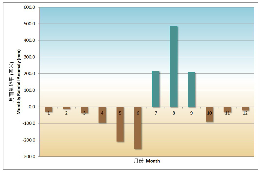
But heavy rain from July to September brought the total rainfall for the year to 2,558.7mm, about 5 percent more than the 1991-2020 normal of 2,431.2mm, the HKO data shows. The concentrated rainfall in the two months contributed more than 80 percent of the total annual rainfall.
Sixteen red rainstorm warning signals and five black rainstorm warning signals were issued, the highest annual numbers on record.
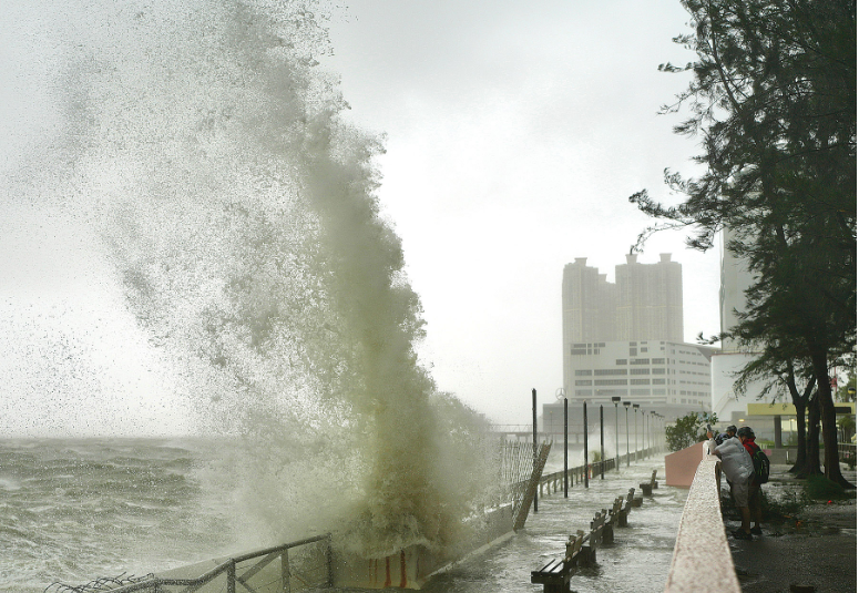
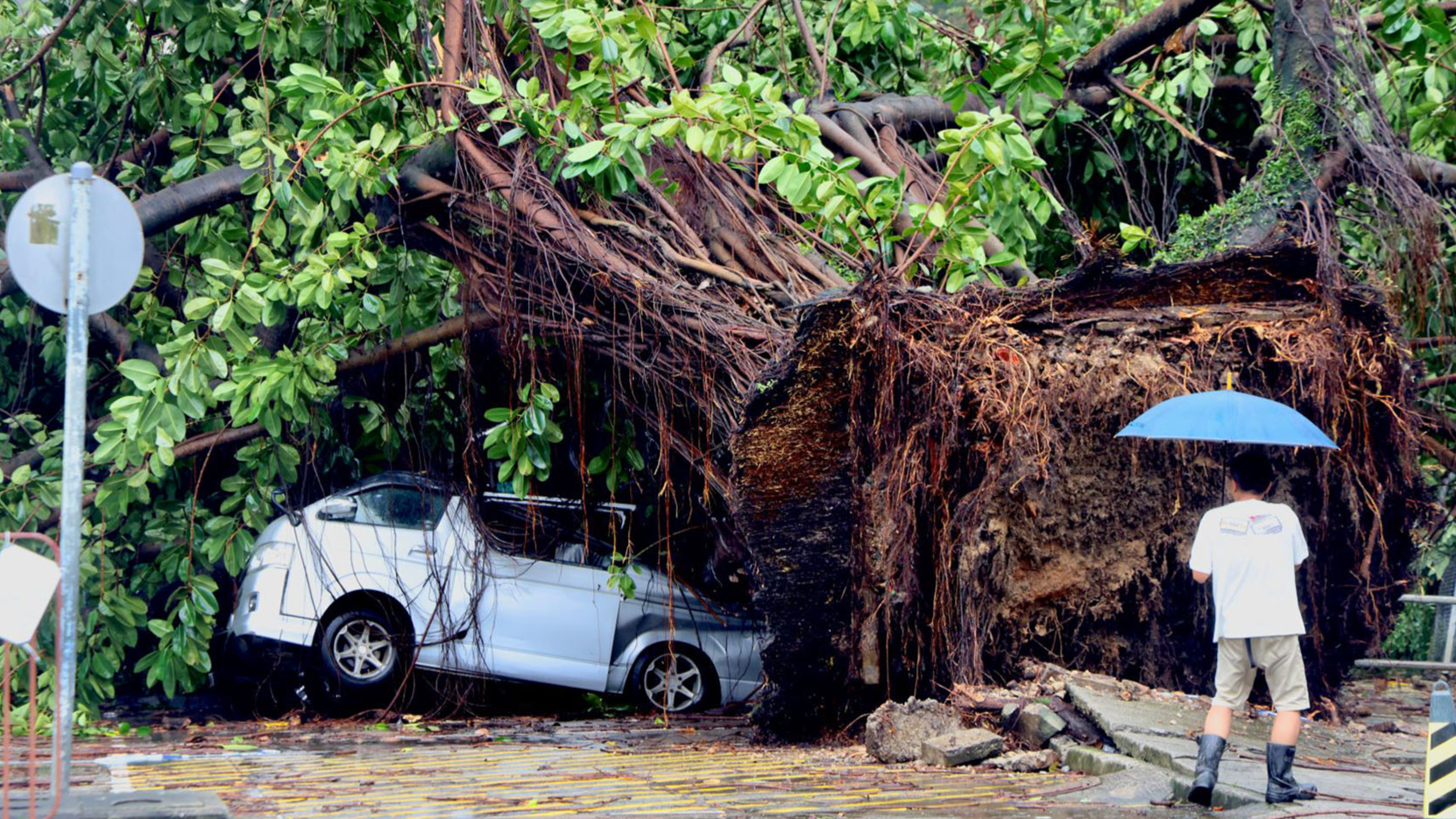
During the year, the HKO issued 14 tropical cyclone warning signals, more than double the annual long-term average of six and the highest since 1946.
The hurricane signal No. 10 was issued twice in 2025 – during Typhoon Wipha in July and Super Typhoon Ragasa in September – tying the previous record of 1964.