
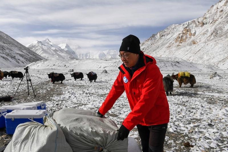
 Kang Shichang, leader of a research team, checks supplies at Mount Qomolangma base camp on May 1 before a scientific expedition. (JIANG FAN / XINHUA)
LHASA-The tan line on Kang Shichang's face is a reminiscence of the eight days and seven nights he spent doing glacier research work on Mount Qomolangma, the world's highest peak, and he deems it his greatest medal.
"Sunscreen obviously did not work so well since I trekked for eight to nine hours a day in the sun," says Kang, a researcher from the Northwest Institute of Eco-Environment and Resources, Chinese Academy of Sciences.
Kang is the leader of the glacier and pollutant research squad, part of the scientific research team in the comprehensive scientific expedition on Mount Qomolangma, also known as Mount Everest in the West.
From May 1 to 8, the 18-member squad scanned a record area of 22 square kilometers at the East, Middle and West Rongbuk glaciers at altitudes between 5,200 meters and 6,500 meters using a drone and a high precision 3D laser scanner. They also measured the thickness of ice and snow and collected some samples at the East Rongbuk Glacier.
Wang Shaoyong, a squad member and a doctor from the institute, says the highly-intensive work was physically challenging.
Wang and his teammates took turns dragging the ground-penetrating radar to measure the glacier ice thickness, following a zigzag trajectory on the surface of East Rongbuk Glacier.
"It felt like my heart was going to pop out," says Wang, 29, adding that his heartbeat reached as high as 160 beats per minute.
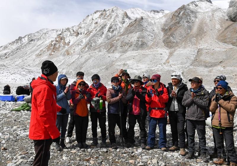 The team gather for last-minute instructions at the base camp before their expedition. (JIANG FAN / XINHUA)
During the period, the squad spent a night in a tent erected at an altitude of 6,350 meters.
Gao Tanguang, an associate professor at the College of Earth and Environmental Sciences, Lanzhou University, says it was a long night, as the low-oxygen environment made it difficult to fall asleep.
When the day broke, their sleeping bags were all soaked with condensation in the freezing tent.
"We couldn't air the sleeping bags outside, because they would become 'ice bags' in the extremely cold conditions," he says.
Gao, who was responsible for operating the drone to scan the glaciers, says that the cold temperature at such a high altitude often rendered his remote control inoperable, causing his drone to be grounded.
"I had to warm the remote with my body to ensure its normal operation," he says.
Despite all the difficulties, the squad members say their field investigations were valuable.
Based on the scanned data, the research squad will draw a 3D digital elevation map of glaciers in the Mount Qomolangma area, and then compare it with the data collected in the past, including remote sensing data, to get the trend and pattern of glacier change. The scientific researchers will also further analyze the ice and snow samples to observe the chemicals in the glaciers.
"Through the study of glacier changes and glacier air pollutants, we can see the impact of global and regional human activities in the Qomolangma area," Kang says.