
Conquerors of Qomolangma attend launch of tome giving fascinating insight into the Himalayas, Yang Yang reports.
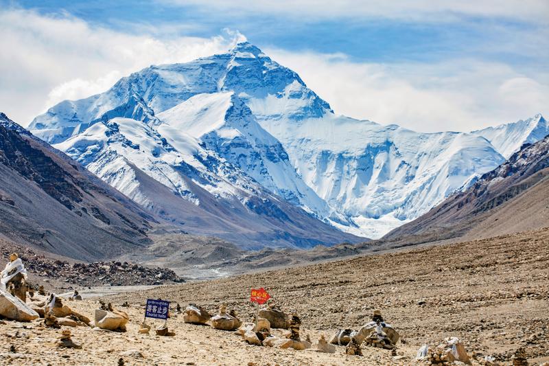 A photo of the key protected area of Qomolangma, known as Mount Everest in the West. (PHOTO PROVIDED TO CHINA DAILY)
Tselo knows what it's like to be on top of the world, to scale the summit of his ambition. On May 27, 2020, Tselo, from the Tibetan ethnic group, alongside eight other members of the Chinese national mountaineering team for the mapping and surveying of the elevation of Qomolangma, reached the highest peak in the world. They achieved their feat after three days battling horrendous gales that registered wind speeds of 20 to 24 meters per second.
In those three dramatic days, they climbed from 7,028 meters above sea level, to 7,790, then 8,300 without sleep, before finally reaching the top.
"We failed twice before," said Tselo, the team's captain, at the recent launch ceremony of the book Zoujin Diqiu Zhidian (Approach the Summit of the Earth) in Beijing.
Published by SinoMaps Press, the finely decorated book is an encyclopedic introduction into Qomolangma, known as Mount Everest in the West. It covers the formation of the Himalayan mountain range and the Qinghai-Tibet Plateau 65 million years ago, scientific investigations into its environmental change, 18 routes to climb it, how to measure its elevation, which has been changing constantly with crustal movements, and last but not least, environmental protection.
The bulky, hard-cover book also contains 132 photos and 84 fine illustrations depicting the splendid views of Qomolangma as Asia's water tower and as the highest of nine peaks in the Himalaya Mountains, as well as its geological structure, ecosystem and atmosphere, among other items of interest.
With detailed maps and graphics, it provides a fascinating insight into Qomolangma, and its new height, and tells the chequered history of China's surveying and mapping of the mountain. Readers can also scan QR codes on the pages, accessing audio, video and a virtual reality 3D map.
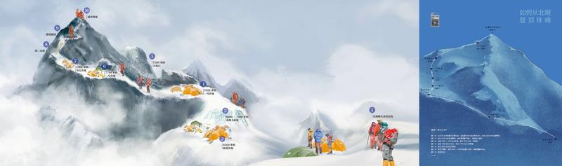 An illustration showing the route to the top of Qomolangma from the north slope of the mountain. (PHOTO PROVIDED TO CHINA DAILY)
Based on the previous six big-scale scientific investigations in the Qomolangma region, especially the second comprehensive scientific expedition to the plateau in 2018 and 2019, the book was an important attempt to combine scientific research and the popularization of science, says An Baosheng, a director on the book's editorial board, who's also deputy director of the Institute of Tibetan Plateau Research of the Chinese Academy of Sciences.
"Last year, when we were planning the book, we wanted to present the region using the logic of Earth System Science. Now we are happy to see this book tell a good story about a complete system of mountains, rivers, forests, farmlands, lakes, grasslands, sand and ice," An says.
From the evolution of ancient supercontinents Gondwana and Laurasia 360 million years ago, to the collisions of Indian and Eurasian plates 65 million years ago, the book presents the birth of the Earth's highest summit. From the variation of vertical zonation, to the special natural resources of the third pole's cryosphere, the book showcases the forming process of the water tower from which the major rivers in Asia originate.
From the first scientific investigation on the 7,000 square kilometers on the east, north and west sides of Qomolangma in 1959 and 1960 to the second comprehensive investigation on the plateau in 2018 and 2019, the book shows the advancement of Earth System Science in China.
Humans started exploring the peak in 1921 with expeditions by British mountaineers. The book covers the moment when Chinese people first set foot on the top of the mountain in 1960 and other important moments featuring mountaineers from all over the world.
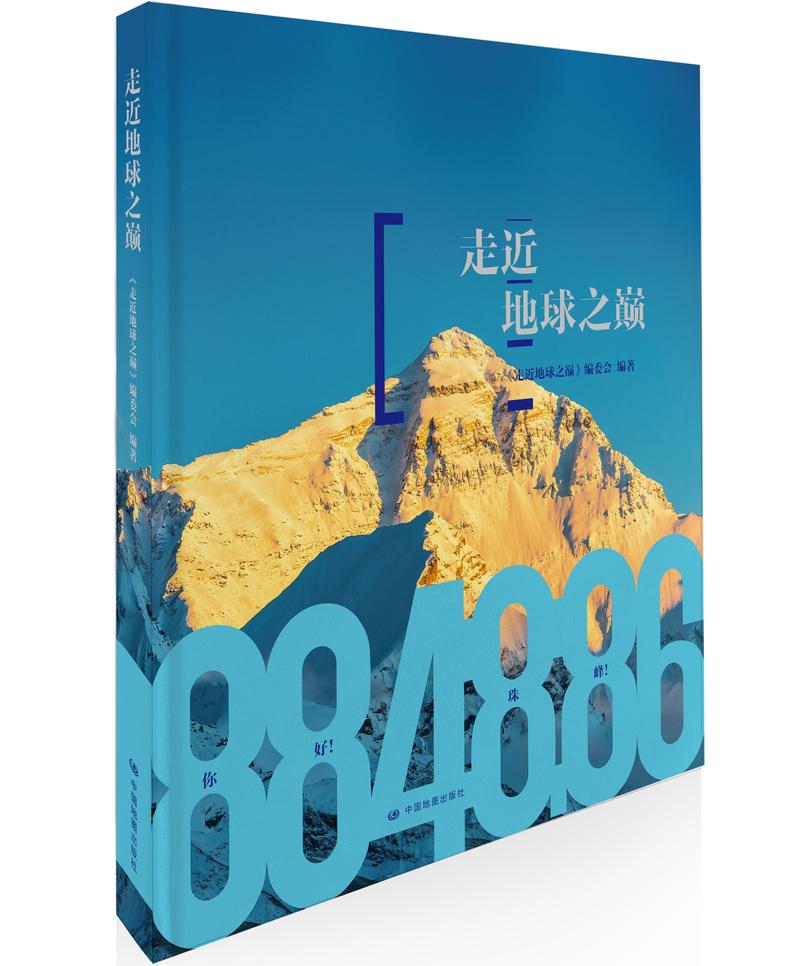 Cover of the book, Zoujin Diqiu Zhidian (Approach the Summit of the Earth), in which the aforementioned photo and illustration are included. (PHOTO PROVIDED TO CHINA DAILY)
It also records the start of China's surveying and mapping of Qomolangma, which began during the Qing Dynasty (1644-1911), all the way to the most accurate ever recording of its 8,848.86-meter elevation in 2020.
On May 27, 2020, Tselo and his teammates stayed on the mountaintop for a record of 150 minutes. They did not plan to stay that long, because at an altitude above 8,800 meters, with the air containing only a little over 30 percent oxygen content compared to at sea level and a temperature of -40 C, it was a dangerous endeavor.
However, they needed time to install the devices to measure the elevation. It was the first time that the Beidou Navigation Satellite System and a Chinese gravity meter were used in the surveying and mapping of the peak.
For a while, Tselo even had to take off his gloves. Fortunately, they all made the descent safe and sound.
"It's a big honor for us because, even though we often climb mountains, it's not often we get to work on a scientific investigation," he says. "We encountered a lot of difficulties during the climb, but thinking about our predecessors in the 1960s, '70s and '80s, we were inspired by the spirit that helped them conquer the difficulties that, nowadays, we cannot imagine."
Besides the national mountaineering team, scientists also encountered a lot of difficulties during their work.
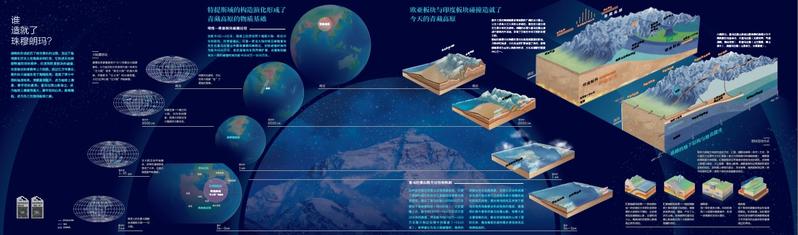 An illustration in the book, which explains how Qomolangma was formed. (PHOTO PROVIDED TO CHINA DAILY)
Wang Zhongyan, senior engineer with Institute of Tibetan Plateau Research, has been working at the institute's Qomolangma Atmospheric and Environmental Observation and Research Station on and off for the last 14 years. Most of the time, there are only two full-time staff members, one part-time worker, and dogs at the station.
He needed to climb the peak every year to set up their equipment at an altitude between 5,800 meters and 6,400 meters.
"Walking at such an altitude is like running a marathon in Beijing wearing five masks. Also, nobody can sleep well, although my fellow scientists say that I snored at night," he says with a grin.
Each survey and mapping of the elevation of Qomolangma displays the unremitting efforts of Chinese people to explore nature, and each improvement in the accuracy of the readings shows the advancement of China's surveying and mapping technology, writes Chen Junyong, academician at CAS, who took part in all the three attempts to survey and map the mountain, in the prescript of the book.
"We hope that the book will provide a window through which readers can learn about Qomolangma and the Qinghai-Tibet Plateau, be a link between science and society, and make a bigger contribution to protecting the third pole and the harmonious coexistence of people and nature," says Chen Ping, general manager of the book's publisher.
Contact the writer at yanyangs@chinadaily.com.cn