
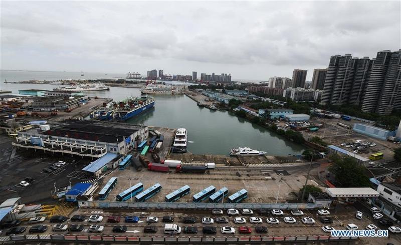
 Vehicles wait to get on ro-ro ships at Xiuyinggang Ferry Terminal in Haikou, south China's Hainan province, Aug 2, 2020. (YANG GUANYU / XINHUA)
Two typhoons and a monsoon are expected to lash vast areas in southern and northern China with downpours in the coming four days, authorities warned.
The National Meteorological Center issued a blue alert, the lowest in the country's four-tier color-coded weather warning system, for Typhoon Hagupit on Sunday.
With a maximum wind speed of 72 kilometers per hour at its center, the fourth typhoon of the year was in waters 690 km southeast of Cangnan county in Zhejiang province at 10 am on Sunday, the center said.
Following the only July without a typhoon in the Northwest Pacific and the South China Sea since 1949, China is expected to be hit by more typhoons than average this month, Xiang Chunyi, a senior engineer with the National Meteorological Center, said
It said the typhoon was moving northwest at 15 to 20 km/h and is expected to make landfall on the coast between Zhejiang and Fujian provinces on Monday night.
"The cyclone will quickly weaken after it lands," the center added.
ALSO READ: China on yellow alert for Typhoon Hagupit
Gales will strike some areas in Jiangsu, Zhejiang and Fujian provinces as well as Shanghai and Taiwan from Sunday to Tuesday, and vast stretches of Zhejiang and Fujian will be battered by downpours for two days starting Monday, it said.
On Saturday, the national observatory issued a blue alert for Typhoon Sinlaku, the third typhoon of the year. Though it has left China as it heads northwest, it could still result in gales and downpours in some parts of the country.
From Sunday to Thursday, Guangdong and Hainan provinces and Guangxi Zhuang autonomous region will be hit by downpours, with total precipitation of up to 350 millimeters expected, the center said.
Following the only July without a typhoon in the Northwest Pacific and the South China Sea since 1949, China is expected to be hit by more typhoons than average this month, Xiang Chunyi, a senior engineer with the center, said.
Since 1949, an average of 1.9 typhoons have made landfall in China each August, but two to three are expected this month, she said.
Also on Sunday, the center issued a blue alert for severe convective weather, which is characterized by strong winds, hail, thunderstorms and brief but heavy rainfall.
The alert warned of torrential rains with hourly precipitation of 30 to 50 mm in 16 provincial-level regions, including Shandong, Heilongjiang, Jilin and Hebei provinces and Beijing in the 24 hours starting 2 pm on Sunday.
State Councilor Wang Yong has called for all-out efforts in flood control and post-disaster recovery to ensure the safety of people's lives and property.
Wang, also head of the State Flood Control and Drought Relief Headquarters, made the remarks during an inspection of flood control and disaster relief work in Anhui province on Friday and Saturday.
Noting that risks and hidden dangers are rising as high water levels in rivers, lakes and reservoirs threaten flood control infrastructure across the country, Wang stressed efforts to closely monitor flood conditions, strictly guard against safety risks and prepare for typhoons and heavy rainfall to prevent major disasters and casualties.
He also asked local authorities to enhance support for flood victims in terms of epidemic control, livelihood assistance, production, hygiene and compensation to restore business activity and daily life to normality as quickly as possible.