
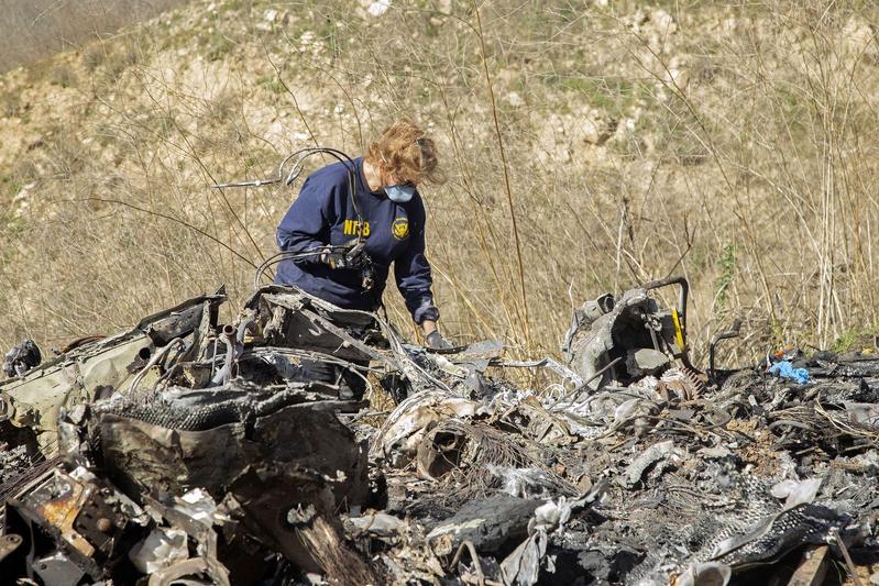
 In this undated photo, an investigator works at the scene of the helicopter crash that killed former NBA star Kobe Bryant and his 13-year-old daughter Gianna on Jan 27, 2020 in Calabasas, California. (JAMES ANDERSON / NATIONAL TRANSPORTATION SAFETY BOARD / GETTY IMAGES / BLOOMBERG )
The area near Los Angeles where Kobe Bryant’s helicopter crashed was blanketed by a thick layer of clouds and the craft’s engines were operating as it plummeted, according to a newly released report.
The National Transportation Safety Board released several photographs provided by government agencies and individuals depicting the first hard evidence confirming early witness reports that the aircraft entered the clouds before it lost control and slammed into a hillside on Jan 26 and burned.
Wreckage from the high-velocity impact in Calabasas, California, suggests that the Sikorsky S-76B’s engines were operating as it went down, according to the NTSB report
ALSO READ: Kobe Bryant's widow breaks silence on NBA superstar's death
Bryant, a basketball legend; his 13-year-old daughter, Gianna; and seven others died in the crash.
A camera used to scan area mountains for wildfires showed that clouds obscured the hills from 731 meters altitude and below, according to the NTSB update. The helicopter pilot climbed to 701 meters shortly before the accident, but apparently never cleared the clouds.
Wreckage from the high-velocity impact in Calabasas, California, suggests that the Sikorsky S-76B’s engines were operating as it went down, according to the NTSB report. That would rule out an engine failure as a reason for the crash.
READ MORE: NTSB: Kobe Bryant's copter lacked terrain warning device
A witness who was on a mountain bike trail near the crash said the helicopter rolled so far to the left that he could see its belly, the NTSB said. The copter was falling at more than 1219 meters per minute in the seconds before impact, according to the report.
The NTSB’s investigative update didn’t include any conclusions about the cause of the crash.