

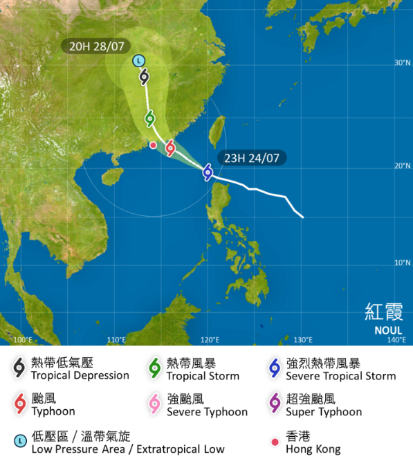
Hong Kong’s weather forecaster has said it will consider issuing the No 3 strong wind signal on Saturday afternoon with tropical cyclone Noul edging closer to the city.
At 8:40 pm on Friday, the Hong Kong Observatory issued standby signal No 1, saying that the alert will remain in force at least until Saturday noon.
The observatory said it will continue to assess the possibility of issuing higher tropical cyclone warning signals later on Saturday night.
“According to the present forecast, Noul will maintain a distance of over 300 kilometers from Hong Kong on Saturday morning,” it said in a 10:45 pm bulletin.
RELATED ARTICLES
- HKO: 4 to 7 typhoons may hit Hong Kong this year
- HKO: ‘Dim-sum’ among nine new names for this year's typhoons
- Temperatures drop as showers drench Hong Kong
Under the influence of the outer subsiding air of the cyclone, it will be very hot during the day on Saturday, according to the HKO.
With Noul intensifying and edging closer to the coast of eastern Guangdong, local winds will strengthen gradually with occasional squally showers later on Saturday.
Warning that there will be swells, the forecaster advised people to stay away from the shoreline and not to engage in water sports.
Noul is expected to have a higher chance to make landfall in the vicinity of Huizhou to Jieyang at first on Sunday.
“However, its distance from Hong Kong and the size of its gale winds at that time remain uncertain. If Noul adopts a more westwards track, its associated gale winds may affect some coastal areas of Hong Kong,” reads the HKO bulletin.
On Sunday, it will be windy with heavy squally showers and thunderstorms over Hong Kong under the influence of Noul, it added.
