

The Hong Kong Observatory on Monday issued the typhoon warning signal No 1 due to approaching Tropical Cyclone Fung-wong, adding that the T1 signal was expected to remain in place until noon on Tuesday.
The HKO issued the Standby Signal, No. 1 at 12:20 pm, with Fung-wong expected to maintain a distance of over 600 kilometers from Hong Kong on Monday before edging closer to the city in the next two days.
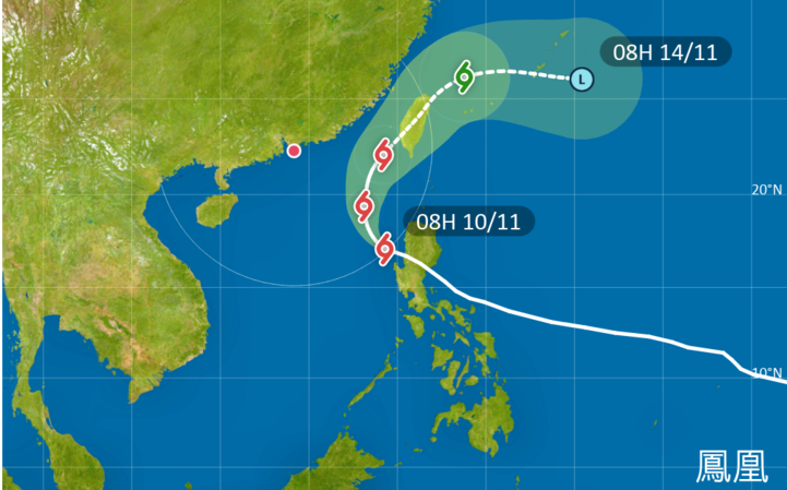
“It is expected to be closest to Hong Kong between tomorrow night and Wednesday at first, skirting more than 400 kilometers to the east of Hong Kong,” the observatory said.
Depending on the intensity change of Fung-wong and its distance from the territory, the impact of the northeast monsoon, and local wind conditions, the observatory said it will assess the need for issuing the Strong Wind Signal, No 3 or the Strong Monsoon Signal.
Under the combined effect of Fung-wong and the northeast monsoon, the water level over the coast of Hong Kong will be generally about 0.5 meters higher than normal during the high tide on Monday night, the observatory said.
It said flooding may occur in some low-lying coastal areas in the small hours, with the water level in Victoria Harbour rising to around 3 meters above chart datum.
There will be swells and members of the public are advised to stay away from the shoreline and avoid water sports, the observatory added.
ALSO READ: HKO: T1 on Monday as Fung-wong to skirt 400km east of HK
At 6 pm, Fung-wong was estimated to be about 680 kilometers southeast of Hong Kong, packing maximum sustained winds of 130 kph.
The observatory said the typhoon was forecast to move northwards towards the vicinity of Taiwan region, moving away from the city and weakening gradually under the influence of the northeast monsoon.
It added that temperatures in urban areas will fall to around 20 degrees Celsius midweek this week, while the minimum temperature in Ta Kwu Ling in the New Territories could drop to as low as 18 C on Thursday and Friday.