
The Hong Kong Observatory cancelled all tropical cyclone warning signals at 11:20 am on Thursday, with the threat posed by Ragasa, which skirted the city with super typhoon strength a day earlier, diminishing significantly.
“Ragasa is moving away gradually from Hong Kong and is expected to weaken further,” said the forecaster.
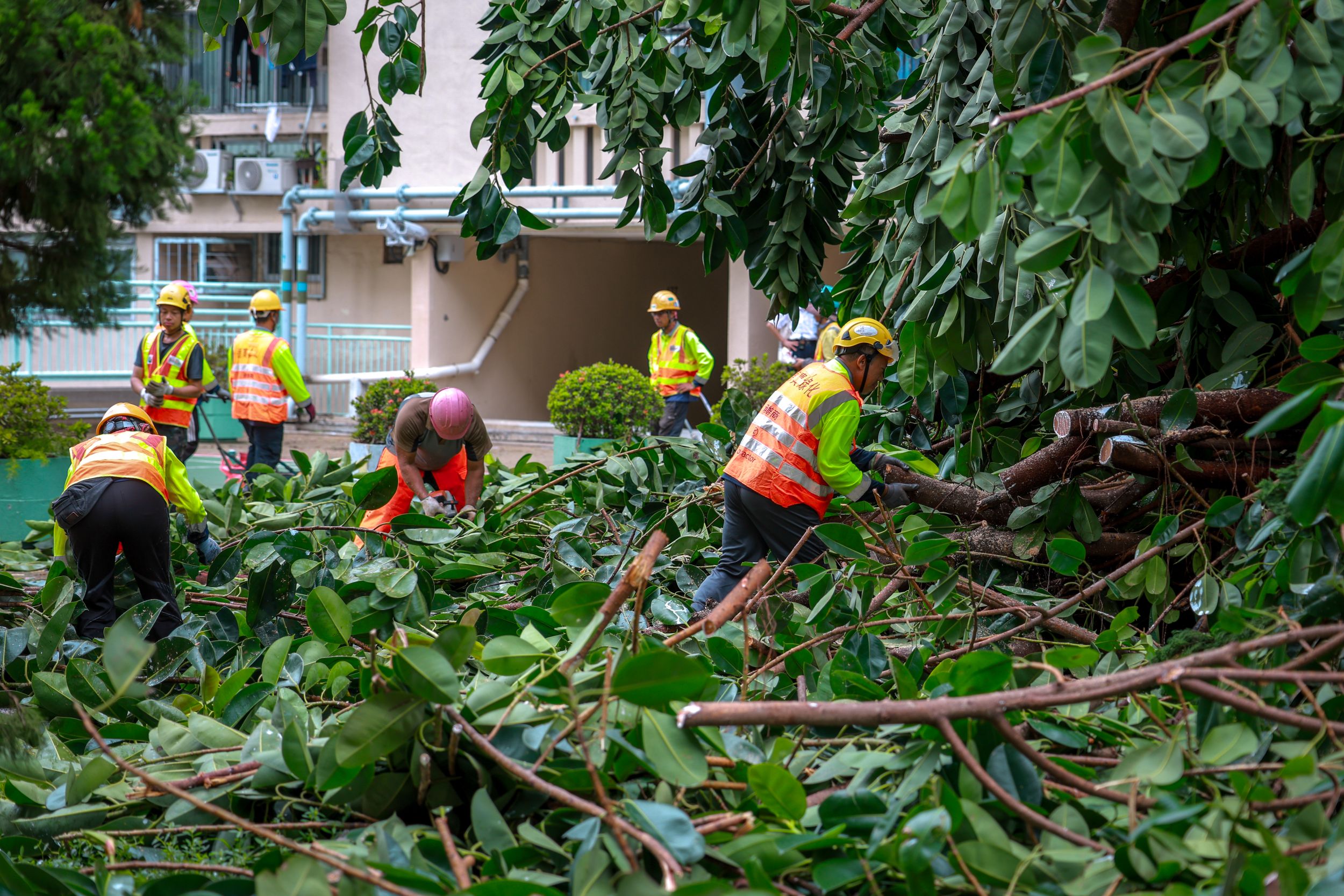
As the city reopened on Thursday morning, hundreds of workers were seen busy in cleanup works, removing trees that had fallen by the world's most powerful cyclone this year and debris strewn across the city.
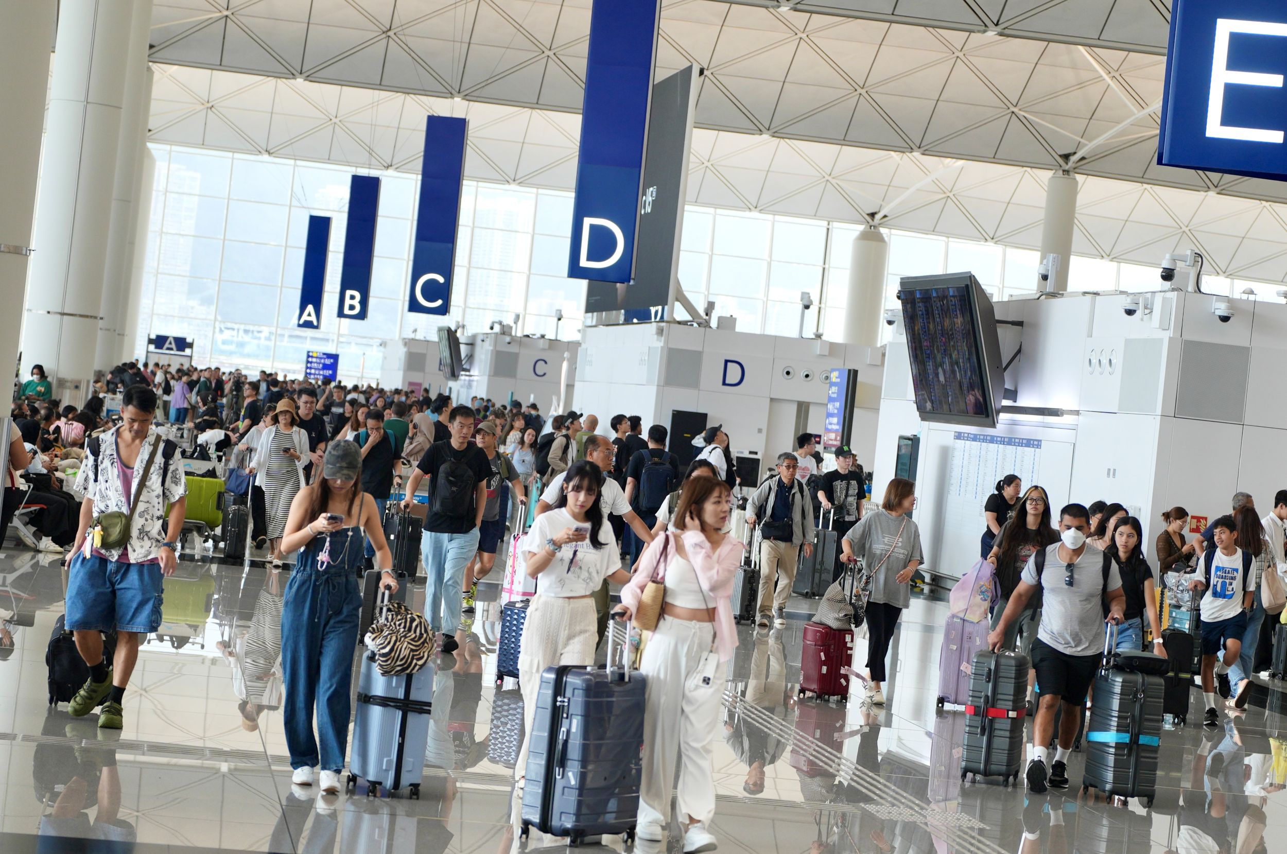
Schools and businesses resumed, as did flight operations at the Hong Kong International Airport after a 36-hour suspension.
Long queues formed in front of the check-in counters at the airport after airlines gradually resumed flights starting at 6 am, with all three runways operating simultaneously.
More than 1,000 flights are scheduled for Thursday, the Airport Authority Hong Kong said, although it is likely to take two days to clear a travel backlog of around 140,000 passengers.
RELATED ARTICLES
- Ragasa leaves after battering HK
- HK airport to gradually resume operations from Thursday
- HK proves resilient in battle against Ragasa
- Typhoon Ragasa weakens after landfall in Guangdong
After sweeping through the Philippines and China’s Taiwan, where it killed 14, Super Typhoon Ragasa lashed Hong Kong on Wednesday, forcing the authorities to issue the highest typhoon signal 10.
Huge waves crashed over areas of the city’s eastern and southern shoreline as Ragasa was skirting Hong Kong with hurricane-force winds. Seawater surged through the Fullerton hotel on the island's south, shattering glass doors and inundating the lobby.
As of 8 pm on Wednesday, there had been more than 1,000 reports of fallen trees, 22 flooding, and four landslides. Total 101 people — 59 males and 42 females — were reported injured and had received treatment at public hospitals.
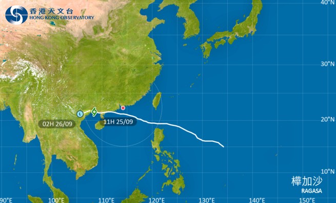
After the typhoon had made landfall over Yangjiang in Guangdong province on Wednesday afternoon, the HKO issued typhoon signal No. 3 at 8:20 pm, replacing signal No. 8. At 8:20 on Thursday morning, the observatory further lowered it to signal T1.
Under the combined effect of the ridge of high pressure over the coast of southeastern China and Ragasa, there will still be strong winds offshore and on high ground on Thursday, said the HKO.
Occasional squally showers, which will be heavier first, and thunderstorms are expected during the day.
Cautioning that there will be swells, the observatory advised members of the public to stay away from the shoreline and not to engage in water sports.
Meanwhile, Tropical Cyclone Bualoi over the western North Pacific is forecast to move towards the Philippines and enter the South China Sea on Thursday and Friday.
It will then move across the central and southern parts of the South China Sea in the general direction of the seas south of Hainan Island, the HKO added.