
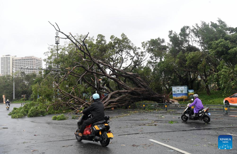
BEIJING/HAIKOU - South China's coastal provinces of Hainan and Guangdong on Thursday moved in lockstep to activate their Level-IV typhoon emergency response measures, as the year's 17th typhoon approached.
Typhoon Mitag was located approximately 340 kilometers southeast of Shanwei city, Guangdong province, at 6 pm on Thursday, with maximum sustained winds of 18 meters per second at its center, according to the National Meteorological Center.
As its strength increases, Mitag is moving northwestward at 15 to 20 kilometers per hour.
It is forecast to make landfall along the Guangdong coast between Huilai county and Taishan city from noon to night on Friday, likely as either a tropical storm or a severe tropical storm — bringing torrential rains to Guangdong on Friday and Saturday before weakening and continuing northwestward.
The Guangdong flood control headquarters has ordered all local authorities to closely monitor the typhoon and implement emergency response measures to ensure public safety and safeguard property.
In Hainan, the typhoon emergency response applies only to marine operations - as strong gales are forecast from Thursday afternoon through Friday. The province's flood control headquarters has urged offshore operation platforms and vessels in the northeastern South China Sea to monitor the typhoon closely and take precautionary measures.
China has a four-tier emergency response system, with Level I representing the highest severity.
ALSO READ: Signal No 3 in force as storm Mitag edges closer to Hong Kong
Meanwhile, the State Flood Control and Drought Relief Headquarters activated a Level-IV emergency response for Guangdong.
Due to Mitag's impact, torrential rainstorms are expected to affect parts of Guangdong and East China's Fujian province from Friday to Sunday, the National Meteorological Center said.
Heavy rains or rainstorms are also forecast for some regions in East China's Jiangxi, Central China's Hunan, and Guangxi and Hainan, both located in South China during the same period.
The national observatory has urged local authorities to implement emergency measures in preparation for the typhoon - and potential flooding and geological disasters that may be triggered by the heavy rainfall.
Flood control in four provincial-level regions
Also on Thursday, the Ministry of Water Resources activated a Level-IV emergency response for flood control in four provincial-level regions, as heavy to torrential rains are forecast to sweep across these areas.
According to forecasts, heavy rainfall is expected to batter parts of Sichuan and Chongqing, both in Southwest China, Northwest China's Shaanxi, and Hubei in Central China, from Thursday to Saturday - with some areas likely to see torrential downpours.
These downpours may cause sharp water level rises in the Jialing River, Qujiang River and Hanjiang River, as well as the Huaihe River, while some small and medium-sized rivers in high-risk areas could exceed warning levels.
The ministry has dispatched two working teams to Sichuan and Shaanxi to guide flood-control efforts. It has also urged local departments to strengthen monitoring of rainfall and river conditions - and place special emphasis on reducing risks in small and medium-sized rivers.
READ MORE: South China coastal provinces brace for Typhoon Tapah
Local authorities are urged to pay particular attention to high-risk locations, and to ensure the timely evacuation of people from potential danger areas to safeguard their lives and property.