

Long before foundations are poured, surveyors trek into unmapped wilderness to ensure millimeter-perfect megaprojects
Deep in an uninhabited stretch of the Xizang autonomous region, three surveyors stumbled across the remains of a goat, freshly killed by a predator that might still be watching from the crags.
Zhao Pi, one of the three, felt his pulse quicken. Miles from the nearest road, carrying delicate equipment, a satellite phone and limited supplies, Zhao knew the measurement point they needed was still ahead. He adjusted the 10-kilogram protective case strapped to his back and kept walking.
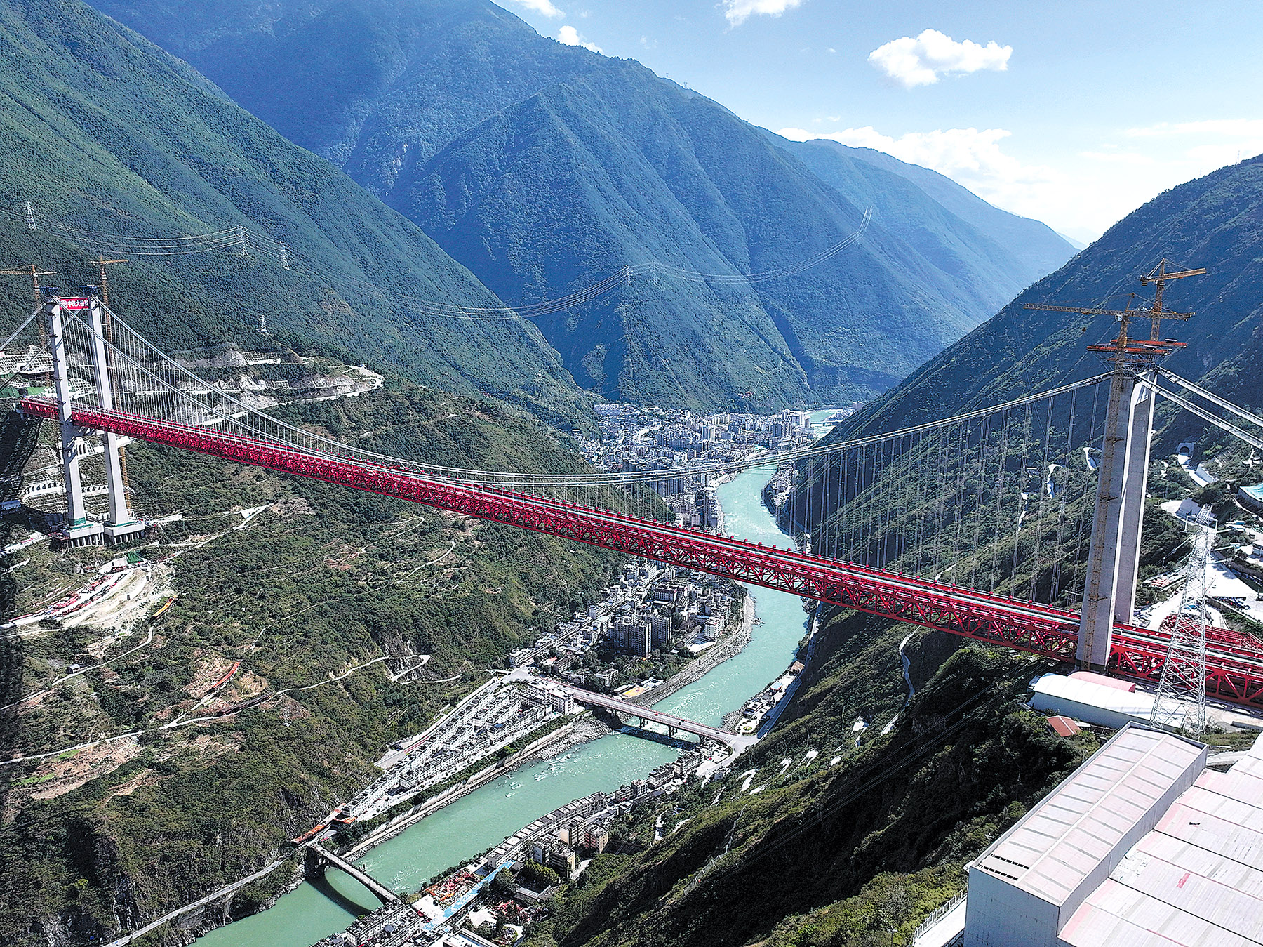
Before a single foundation was poured or a single track laid for the Sichuan-Xizang Railway, men like Zhao must tread the ground first.
Stretching roughly 1,500 kilometers from the lush Sichuan Basin (500 meters above sea level) to the dizzying heights of the Tibetan Plateau (often over 4,000 meters), the route is an engineering moonshot — cutting through volatile fault lines, vertical river gorges and unmapped terrain.
On the Sichuan-Xizang Railway, the geodetic height obtained through standard satellite positioning falls short of construction demands — a problem rooted in the physics of how height is defined.
"Satellite positioning gives you a geometric height, but for building a railway, you need a physical quantity," said Zhao, 40, a gravity surveyor with the Ministry of Natural Resources' First Geodetic Survey Brigade.
Satellite receivers measure height against an ideal mathematical model of the Earth's shape, but what matters for construction is where water would naturally flow — the actual physical level. While the difference between the two height values changes gradually in flat terrain, in mountainous regions with sharply undulating topography, rapid fluctuations in this gap can introduce errors significant enough to affect gradient design decisions for a railway.
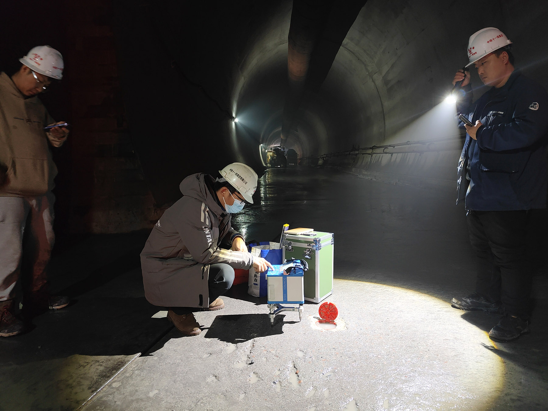
To bridge that gap, surveyors must take ground-based gravity measurements along sections where terrain is complex and elevation changes sharply, Zhao said.
His teams, typically made up of three people, carry a gravimeter — a precision instrument with a spring-based sensor that detects minute variations in gravitational pull — along with satellite receivers, satellite phones and enough food for a full day. The gravimeter weighs about 10 kg in its protective case and demands careful handling at all times.
"It is a very delicate instrument. When we drive, we pad it with foam cushions and slow down for every bump," Zhao said. He added that in places accessible only on foot, they take turns carrying the instrument and need frequent rest.
A single measurement point can require a 10-kilometer round-trip hike through roadless terrain.
Although the automated observation takes less than 30 minutes, reaching the point and returning can consume an entire day. Zhao said that the team must return to base before nightfall because if the gravimeter's battery runs flat, then all the data collected would be lost.
Before Zhao's teams measured gravity in the mountains, another kind of surveying and mapping had already unfolded along the same route.
Chen Chuan, a surveyor with the ministry's Third Geodetic Survey Brigade, spent years working on the Lhasa-Nyingchi section, which crosses three prefecture-level areas — Lhasa, Lhokha and Nyingchi. The railway corridor runs through farmland, pasture and village settlements, with sharply undulating terrain along the route. The work required not only technical precision but also close coordination with local communities.
Chen's team had to survey the entire route and mark boundaries section by section while assisting construction units with land-use approval procedures. Given the project's national significance and tight timeline, land-use permits for key tunnels and bridges were approved early to allow construction to begin, with full-line approvals completed progressively in phases. The work began around 2015 and continued through 2021.
He recalled times when boundaries were contested or compensation areas were in dispute, requiring village committees to mediate and surveyors sometimes to remeasure plots. During fieldwork, Chen picked up basic Tibetan, enough to ask for directions or find a meal in remote villages. Locals were mostly welcoming — sometimes they treated the surveyors to tsampa and other traditional foods.
For Chen, 37, who has spent a decade in surveying, the profession's role is widely underestimated.
"Surveying is the only way to turn design coordinates into physical structures on the ground," he said. "Without it, construction loses its spatial benchmark — we cannot achieve precise positioning and alignment across such drastic elevation changes and complex geology."
The Lhasa-Nyingchi section, stretching 403.14 km, was put into operation in 2021. The more geologically extreme Ya'an-Nyingchi section remains under construction, with surveyors continuing to provide measurement support.
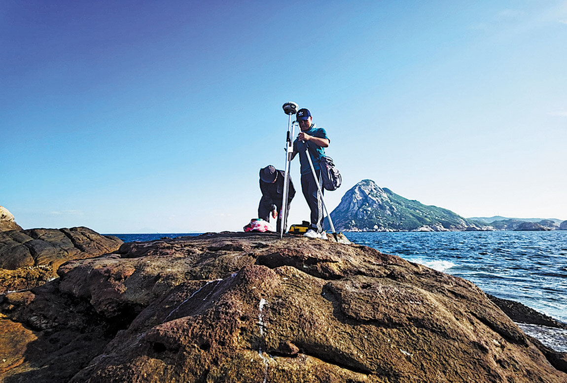
For the Hong Kong-Zhuhai-Macao Bridge — a 55-km crossing that opened in October 2018 as one of the world's longest sea links — the fundamental challenge was simple: three jurisdictions, three coordinate systems and one massive structure that had to be built as a single, continuous whole.
"Each place had its own coordinate system and height reference," said Shang Xiaoqi, a surveyor at the First Geodetic Survey Brigade who led the project's precision engineering survey division.
"We can think of the bridge design as a puzzle. Without a unified benchmark for both coordinates and elevation, you simply cannot bring the pieces together or place them in the correct position," Shang said. "The heights won't match, the positions won't align, and the bridge will twist and deform." He described such a scenario as "an engineering disaster".
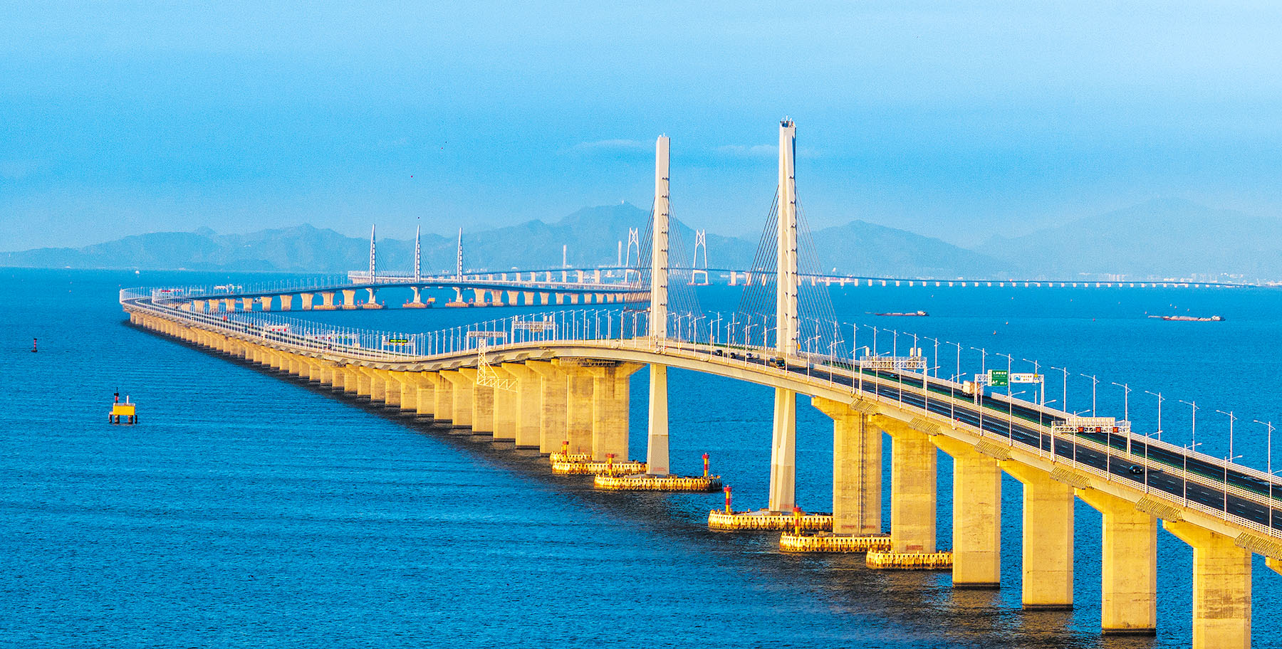
He took elevation benchmarks as an example, noting that the real danger lies in what surveyors call an "elevation break" — two halves of the bridge, built from opposite shores using different elevation benchmarks, could misalign by tens of centimeters or even meters at the final closure. Such a mismatch would not surface during early foundation work. It would appear at the worst possible moment: when the bridge was supposed to close its final gap.
Before the bridge existed, Shang's team had to transfer elevation data from the Zhuhai side all the way to the Hong Kong side — a task that, with no bridge to walk across, meant routing through Shenzhen. The team measured on foot, crossing the river at the Futian Port border crossing and making its way to Lantau Island.
The total distance was more than 250 km of leveling, measured step by step. Along the route, the team had to cross more than a dozen rivers and sea areas, requiring precision leveling methods to maintain accuracy across the entire line.
"Every observation point and every kilometer mattered," Shang said.
The team was tasked with establishing the primary control network that would unify horizontal and vertical data across all three jurisdictions. They placed 16 observation points around the bridge corridor — eight on the Zhuhai side, six on the Hong Kong side and two on the Macao side.
Shang recalled one observation point on a mountaintop in Hong Kong where no trail existed. "The vines had sealed off the entire mountain. There was no path up at all, and we practically crawled our way to the top," he said. "It took hours to reach the summit, and by the time we came down, it was already pitch dark."
ALSO READ: Surveyors take giant steps to recalculate height of Qomolangma
The team also pushed precision to extremes. "We would sometimes remeasure sections that had already met the standard but were close to the tolerance limit, just to bring the error down further. Sometimes a five-person crew would spend an entire day repeating a section to improve an already acceptable result by a few hundredths of a millimeter," he said.
The team's work was delivered in March 2009. But those 16 points did not disappear when the bridge opened. Some became local high-grade survey control points, serving urban planning, land management and survey monitoring. Others were upgraded to continuous satellite monitoring stations, tracking the structure's response to typhoons, ocean currents and vessel traffic in real time — measuring pier displacement, deck movement and settlement at key spans.
Shang remembered a flight over the Pearl River Delta while the bridge was still under construction. Looking down, he saw two unfinished sections reaching toward each other across the water.
"I realized right then that our work was playing a major role," he said. "To know that your work contributed to a megaproject of this scale — that is something to be proud of."
While the bridge represents an investment of over 120 billion yuan ($17.8 billion), the surveying work that made it possible represents a fraction of that cost — both in time and money. But for Shang and his colleagues, that has never been the point.
"Surveying is critical, yet it stays behind the scenes," Shang said.
"For any major project, people think of the designers, the engineers, the construction crews — they rarely think of the surveyors who went first. But behind the Shenzhou spaceship, the West-to-East Gas Pipeline, the South-to-North Water Diversion Project, every one of these major achievements, surveyors were there. That is the value of our work, and that is enough," he said.
Contact the writers at limenghan@chinadaily.com.cn
