

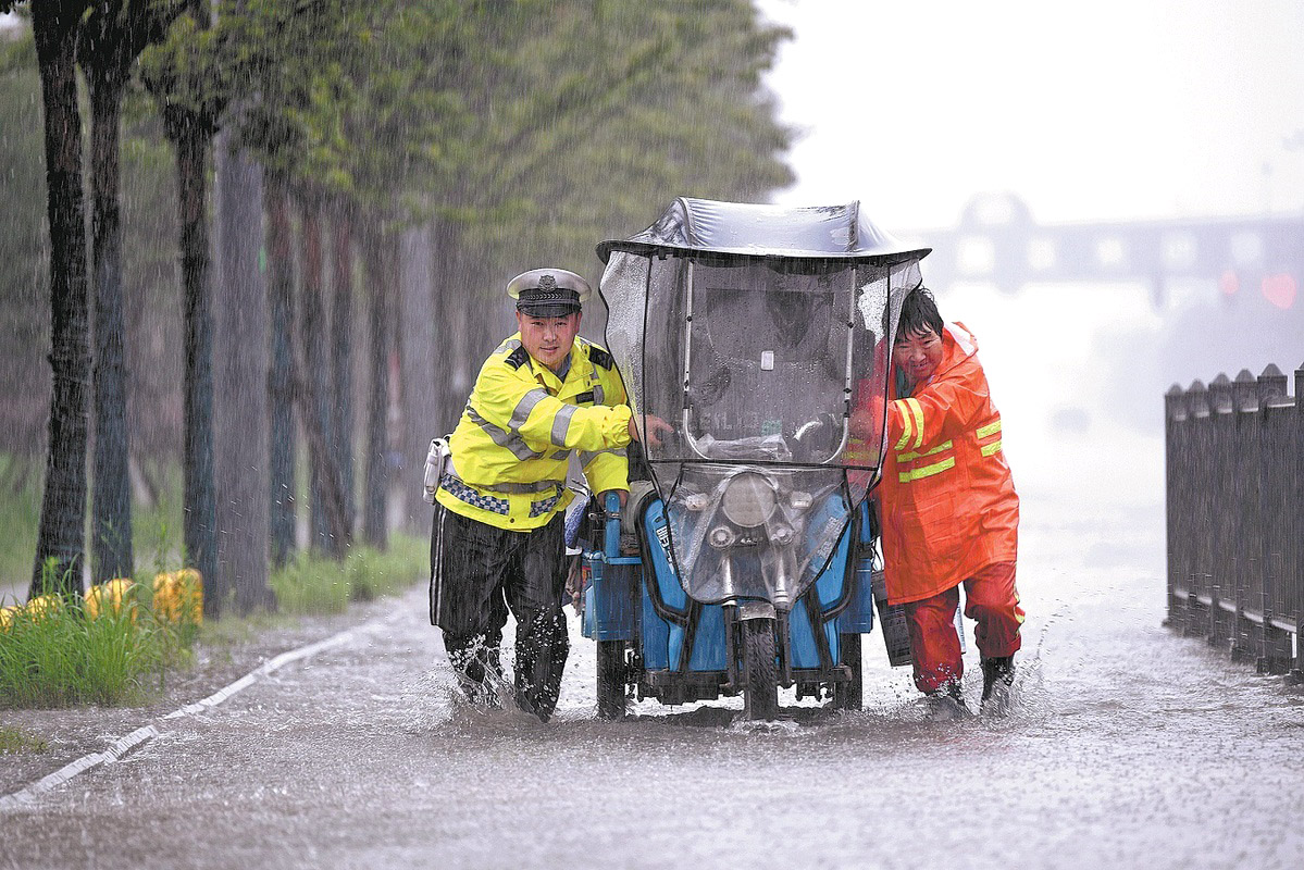
As Typhoon Bavi moves farther inland after making landfall in Zhejiang province, the biggest threat to northern China may not be damaging winds, but days of torrential rainfall, meteorologists said.
By Monday morning, Bavi had weakened as it moved north-northeast slowly across Anhui province. However, its expansive rain bands continued to spread across much of eastern China, affecting provinces from Fujian and Zhejiang to Shandong, Liaoning and Jilin.
Chen Tao, chief forecaster at the National Meteorological Center, said Bavi is expected to move northeast at about 15 kilometers per hour, crossing Jiangsu and Shandong provinces before entering the northern Yellow Sea around midday on Tuesday.
READ MORE: Typhoon Bavi brings heavy rain, flood alerts to North China
Although the typhoon is expected to continue weakening, its impact should not be underestimated, especially in Liaoning and Jilin, where rainfall could be exceptionally intense, Chen said.
Northern Liaoning and central Jilin could receive exceptionally heavy downpours, with isolated areas forecast to receive 300 to 450 millimeters of rain. In some places, daily rainfall could exceed historical records, he said.
Unlike typhoons that strike southern China and rapidly weaken after moving inland, storms that track northward often pose a different threat.
Even as their winds diminish, they can produce widespread and persistent rainfall, triggering floods far from where they first made landfall.
Bavi continues to draw vast amounts of tropical moisture northward, creating a sustained flow of humid air into northern China. If both the storm and the surrounding weather systems move slowly, rainfall could persist for several days, significantly increasing the risk of flooding, Chen said.
Zhao Dajun, a researcher at the Chinese Academy of Meteorological Sciences, explained that a key factor determining a typhoon's track is the western Pacific subtropical high, a large high-pressure system that acts as a steering mechanism for tropical cyclones.
When the system extends farther west, typhoons are more likely to head toward southern China. When it weakens or shifts eastward, however, storms have more room to turn north, moving across eastern China toward the Yellow Sea and eventually Northeast China.
As Bavi moves northward, it is also being steered by stronger upper-level winds that help carry the storm to higher latitudes, Zhao said.
Another reason Bavi has been able to travel so far inland is that sea surface temperatures in the East China Sea and the Yellow Sea remain relatively warm, providing enough energy for the storm to maintain its circulation longer than usual.
The storm may weaken, but its capacity to produce heavy rainfall often remains intact.
As a result, Northeast China could still experience severe rainfall even if the storm's center does not pass directly overhead, meteorologists said.
Gao Xiaoyu, an associate researcher at the academy, said mountainous terrain could further intensify rainfall. As moisture-laden air is forced up mountain slopes, it cools and condenses, producing heavier precipitation. Similar terrain in Liaoning and Jilin could locally enhance rainfall as Bavi moves into Northeast China.
The storm could also affect coastal areas.
ALSO READ: Chinese vice-premier stresses reservoir safety during flood season
As it passes over the Yellow Sea and Bohai Sea, strong winds may push seawater toward the coast, raising sea levels and increasing the risk of storm surges in parts of Shandong and Liaoning, especially if the storm coincides with high tide, Gao said.
Looking ahead, China is likely to face two to three more typhoons during the late July to early August flood season, Chen Tao said.
Five to six typhoons are expected to form over the Northwest Pacific and the South China Sea during the period, with two to three making landfall in or affecting China.
One particularly strong typhoon could bring significant wind and rain to northern regions, Chen added.
Contact the writers at zhaoyimeng@chinadaily.com.cn
