
Human-animal conflict reduced by alerting farmers to danger, guiding rangers in making responses
In the parched lands of Kajiado, where dry winds sweep across the plains and nights herald an unsettling quiet, a farmer who once lost sleep over marauding elephants now receives instant alerts before a single tusker appears near his home or crops.
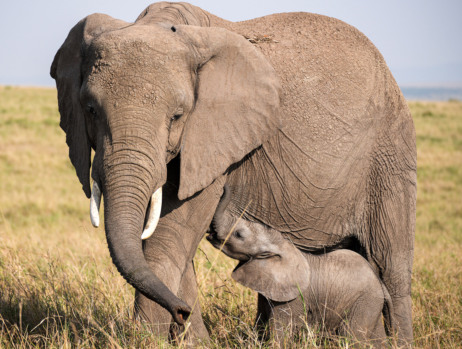
For years, darkness meant danger as the pachyderms could flatten entire fields in minutes, leaving families with nothing but the huge footprints of the majestic giants and a season's worth of hope trampled into dust.
However, early warnings and coordinated responses have put an end to what was once a nightly terror across the vast mosaic of Kenya's landscapes, from the sprawling Maasai Mara to the iconic elephant corridors of Amboseli, from the rugged plains of Tsavo to the ranchlands of Laikipia and the buffer zones beyond.
Early-warning systems now stretch like an invisible safety net over communities, alerting farmers to approaching herds, guiding rangers in making coordinated responses and transforming once unpredictable nights of fear into manageable, even routine, encounters with nature.
READ MORE: Restored wetlands welcome new flocks of migratory birds
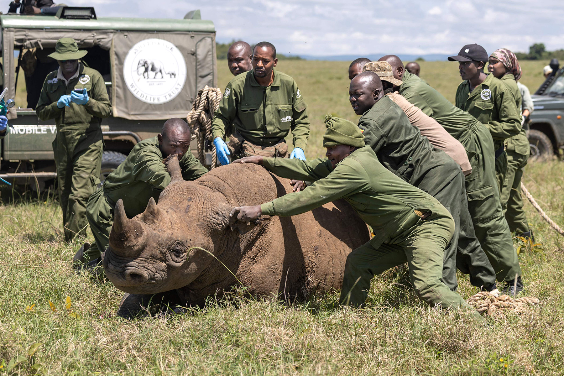
When elephants begin drifting toward a village farm on the edge of protected areas, the breaching of a virtual fence triggers instant alerts across rangers' handheld devices, WhatsApp groups and command centers in Kenya's capital Nairobi. On various screens, the different species appear as moving icons — elephants crossing migratory corridors, lions approaching settlements, rhinos pausing near sanctuary boundaries.
Within minutes, a trained response team is deployed, sometimes guided by drones buzzing quietly overhead, to gently steer the animals back to safe ground. Scenes like this are no longer experimental in Kenya; they are fast becoming routine.
These alerts, relayed through cellphones, radio networks and community rangers stationed deep inside the parks, have transformed human-elephant encounters from chaotic, desperate clashes that left behind destruction in the form of fires and crushed metal sheets into coordinated and manageable interactions.
Farmers who once braced for destruction now have time to move livestock, call neighbors, or activate deterrent systems before a herd reaches the boundary of their farms.
Rangers, too, respond with precision — tracking movements, redirecting herds and defusing potential conflict before it erupts.
Spurred by rising human-wildlife conflict, climate stress, habitat loss and poaching threats, Kenya Wildlife Service, or KWS, has embarked on a sweeping digital transformation, weaving together artificial intelligence, long-range telemetry, thermal imaging and community knowledge to safeguard its natural heritage.
Wildlife resources
"As a government agency responsible for managing our wildlife resources, protecting critical habitats, mitigating conflict and ensuring sustainable utilization of natural heritage, our strategy emphasizes real-time surveillance, advanced analytics and improved response coordination," KWS EarthRanger manager Victor Ian said.
At the center of this shift is Earth-Ranger, a platform integrating data from satellite collars, long-range radio networks, drones, smart camera traps, thermal smart sensor cameras and the Ecoscope analytics ecosystem into a unified operational dashboard.
"When something goes wrong, the system reacts faster than humans can," Ian explained. "The automated alerts allow field teams to respond before conflict escalates." Because of this innovation, Kenya is emerging as a continental leader in wildlife conservation.
KWS oversees wildlife conservation across the East African country, directly managing approximately 20 percent of Kenya's total landmass through national parks, reserves, marine areas and sanctuaries.
To address connectivity challenges in remote parks of Kenya, such as Marsabit and Samburu, the agency is scaling long-range, wide-area network technology with long-range, low-power radio networks capable of transmitting telemetry more than 20 kilometers.
Satellite uplinks and future 5G expansion plans guided by partnerships within government information and communications technology frameworks will also close connectivity gaps and support real-time monitoring across Kenya's isolated conservation landscapes.
Illuminated by invisible eyes, nights — which once provided cover for poachers — are slowly losing their secrecy. Rangers are using thermal cameras to detect movements in total darkness, while acoustic sensors detect gunshots, chain saws and unusual animal distress calls throughout the day and night.
Scientists are also using environmental DNA to detect aquatic species such as hippos or invasive fish without direct observation, revolutionizing population studies. At the same time, underwater camera traps placed across coastal ecosystems are helping researchers monitor coral bleaching and track parrotfish abundance — key indicators of overall reef health.
"These innovations protect not only elephants and rhinos," Ian says, "but also lesser-known species such as pangolins, dik-diks and endangered birds".
Despite the advanced sensors and satellite systems, KWS emphasizes that technology serves as a support, not a substitute for human expertise. "Technology complements, rather than replaces, ranger intuition and indigenous knowledge," said the KWS official. He pointed out how, after suitable training, drone pilots, telemetry analysts and data technicians are emerging from among the communities living alongside wildlife, thus creating new jobs in places where once tourism was the only source of livelihood.
Wycliffe Mutero of the International Fund for Animal Welfare, or IFAW, said landscape fragmentation has strained elephant migration routes across East and Southern Africa. For centuries, elephants traveled along vast, ancient corridors and seasonal highways stretching from the savannas of Kenya to the woodlands of Zambia, and from the Zambezi Valley to the plains of northern Botswana. Today, many of those routes have been hit by expanding farms and towns and the steady development of infrastructure.
"Over the past 200 years, elephant range has shrunk significantly due to agriculture, settlements and infrastructure," Mutero says. "Our Room to Roam initiative aims to reconnect critical landscapes so wildlife and people can flourish together."
Flagship program
The initiative, one of IFAW's flagship programs that seeks to secure more than 9 million hectares of linked habitat across the region, focuses on keeping migratory paths open, restoring degraded rangelands and working with communities whose livelihoods lie directly along the elephant movement routes.
Central to IFAW's philosophy is the idea that conservation cannot exist in isolation. It must be integrated with local development needs, land-use planning and community benefits.
Mutero notes that meaningful progress is already underway with Kenya's conservancies around Amboseli and Tsavo strengthening wildlife corridors through partnerships with local landowners. In neighboring Malawi and Zambia, rangers are improving cross-border surveillance to ensure elephants can move safely through shared ecosystems while community-managed conservancies in Zimbabwe are emerging as important buffers between national parks and growing settlements.
Mutero maintains that conservationists alone cannot solve the problem. "This work is bigger than any single organization. It depends on governments, communities, private-sector actors and international partners pulling in the same direction," he says. "If conservation players and development partners join hands, we can create room for elephants to roam into eternity."
Even as the regional initiatives gather momentum, other experts caution that no single strategy offers a blanket solution. Wildlife Research and Training Institute scientist Sospeter Kiambi notes that while community-focused tourism has benefited parts of Kenya, it cannot be applied everywhere. "Ecotourism can mitigate human-elephant conflict by aligning economic benefits with biodiversity," Kiambi explained. "However, it is not suitable for all landscapes."
ALSO READ: Competition goes wild for nature and science
His recent work, combining species distribution modeling with AI-assisted analysis, found that 19.1 percent of Kenya's landmass faces high human-elephant conflict risk, thus offering limited tourism potential. In these areas and in counties such as Kirinyaga, Embu and Makueni, the communities require alternative interventions: wildlife corridors, electric fencing, early-warning systems and stronger land-use planning. "Ecotourism must be supported by policies promoting habitat connectivity and equitable benefit-sharing," Kiambi said, adding that local realities must shape the solutions deployed.
Kenya's response now hinges on stronger coordination across conservation actors. Roughly 20 percent of the country's land falls under Kenya Wildlife Service management, backed by a patchwork of community conservancies, private sanctuaries, research bodies and county governments.
By sharing data on a unified digital platform, these partners are reducing duplication, synchronizing patrols and detecting threats across boundaries with unprecedented clarity. Cross-border species — including elephants, lions and wild dogs — are now tracked continuously as they move between public and private lands, lowering conflict and strengthening the ecological corridors that underpin both conservation and tourism.
Contact the writers at victor@chinadailyafrica.com