
Long-running shelterbelt forest program ring-fences deserts in country's north, as Zhang Xiao reports
Editor's note: This year marks the 20th anniversary of President Xi Jinping's proposal of the concept that "lucid waters and lush mountains are invaluable assets". To mark the occasion, China Daily is publishing a series of stories on how resources such as mountains, rivers, lakes, forests and farms are being transformed into priceless gifts.
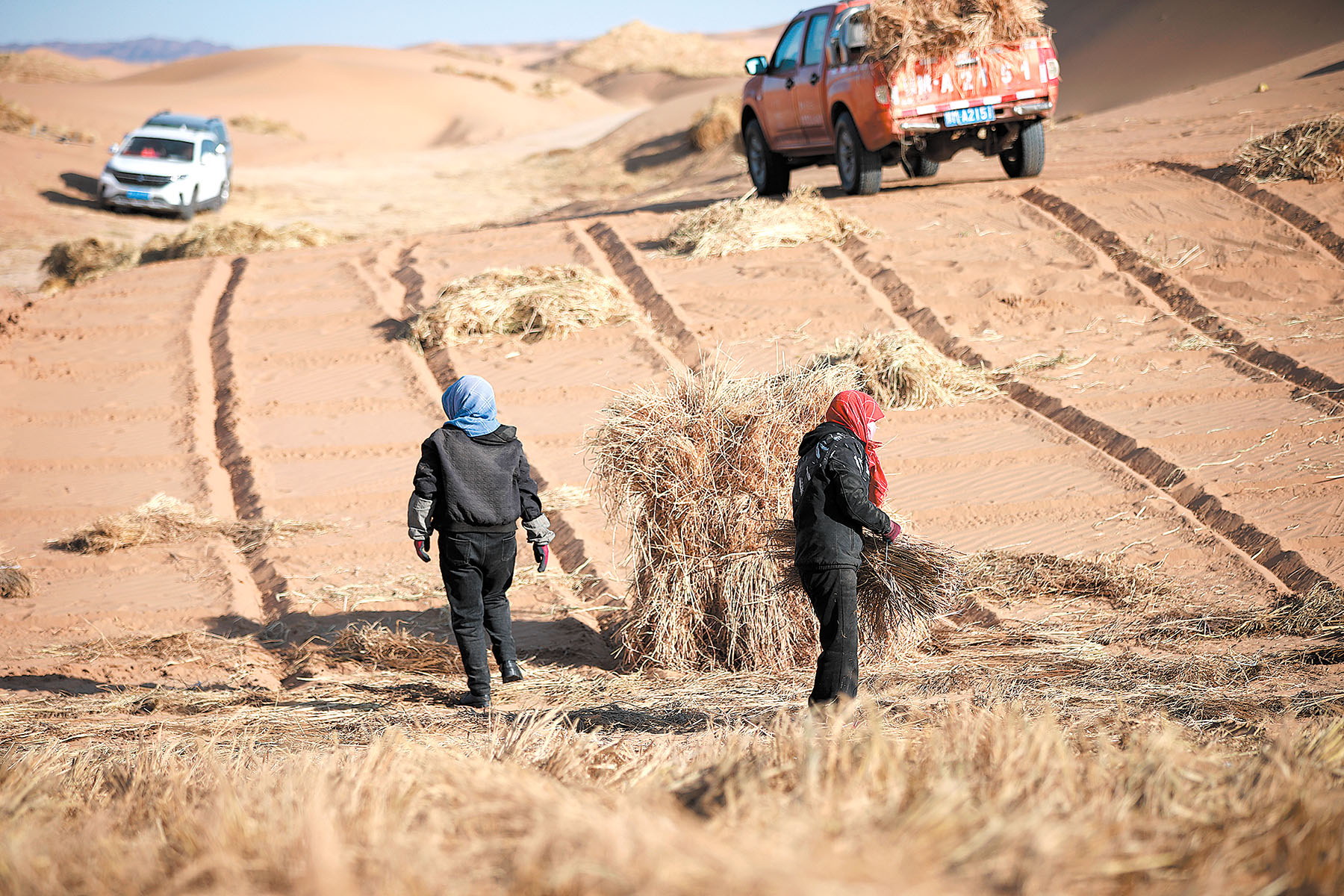
With the planting of the final rose seedling in the Xinjiang Uygur autonomous region's Hotan prefecture on Nov 28 last year, the final link in a 3,046-kilometer chain was put in place, creating a green belt completely encircling 340,000 square km of China's Taklimakan Desert.
What is now the world's longest ecological safety barrier around a desert stretches for a length that roughly equals the straight-line distance from Shanghai to Urumqi.
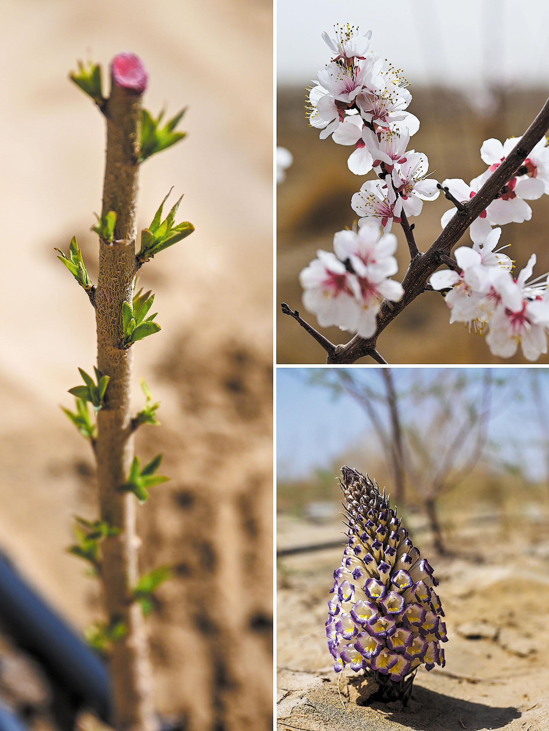
The natural conditions in Hotan are well-suited to growing roses, with the history of their cultivation spanning over 2,000 years.
Initially, local people planted roses in their courtyards to make jam and tea. These varieties have excellent drought and salt-alkali resistance. As the needs of sand prevention grew alongside industrial development, roses became large-scale crops that prevented wind erosion, served as economic crops, and supported industrial development.
READ MORE: Success story blooms amid desert roses
Roses have extensive lateral root systems that branch and sprout extremely quickly. A single plant can form a 2 to 3 meter wide flower ridge within the same number of years. The dense foliage of clustered roses effectively reduces wind speed, fixing sand dunes and preventing soil erosion. The local varieties are recognized worldwide for their high oil yield and superior fragrance profile, producing world-class quality rose products.

Rukiyam Ujabulla, a rose grower in Hotan prefecture's Yutian county, returned to her hometown after graduating with a physics degree. She put her teaching aspirations on hold to help her father and uncle manage the family's rose business.
"At first, we only made rose jam, but later we learned roses can be used for skin care products, wine and even nutritional meals," she said.
Rukiyam sells the family's products such as rose jam, tea, face masks and essential oils via livestream. "We have 3,000 mu (200 hectares) of roses and 42 employees. During harvest season, we employ an additional 200 to 300 flower pickers," she said.
"First forest, then farmland" is the slogan for Hotan's desertification control model. In areas where desert roses have grown for 10 years, the sandy soil has improved enough to support interplanted wheat that is capable of yielding some 3 metric tons per hectare. In just a few years, the region has transformed the desert into an oasis through biological sand control, effectively protecting villages and farmland.
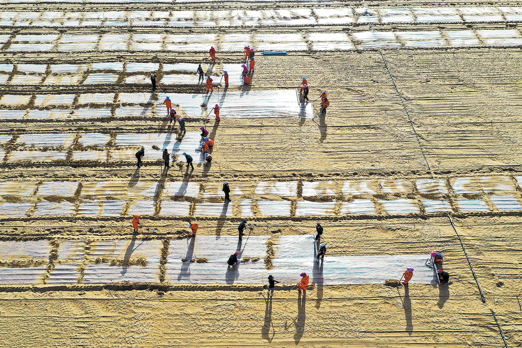
All 27 villages in Yutian have planted windbreak forests and drought-resistant plants on their outskirts, completing biological sand control over more than 30,000 hectares.
Since 2020, sandy weather days per year in Yutian have decreased from 179 to 128, and sandstorm days from 24 to 7.5. By planting tamarisk, saxaul, roses, red dates and other species with both ecological and economic benefits, the project has benefited 8,900 households, 25,000 people and created stable employment for over 2,900 workers.
With ecological restoration as the foundation and industrial benefits as the driving force, this systematic strategy not only protects villages and farmland but also combines desertification control with livelihoods through "ecological industrialization". The approach has formed specialty industry chains for roses and red dates, achieving a positive cycle between ecological governance and economic development.
Green Great Wall
"We're not trying to eliminate the desert," said Feng Yiming, deputy director of the Institute of Desertification Studies at the Chinese Academy of Forestry. "Our main purpose is to lock the edges of the desert to prevent it from shifting."
With over 10 years of experience in Taklimakan sand control, Feng has a deep understanding of the relationship between humans and nature. "What we control is the desert periphery, areas that have deteriorated due to natural and human activities. In a word, it's about human-sand harmony," he said.
The successful "edge-locking" of the Taklimakan Desert means that the Hexi Corridor-Taklimakan Desert Edge Blockade Battle — one of three landmark campaigns of the Three-North Shelterbelt Forest Program — has achieved a significant milestone.
In 1978, China launched the Three-North Shelterbelt Forest Program. It stretches from Heilongjiang province in China's east to Xinjiang in the west, encompassing eight provinces, three autonomous regions and two municipalities, and covering over 4 million sq km.
As the world's largest and longest-running ecological project, it aims to control desertification in the northwestern, northern and northeastern regions of China. After more than 40 years, the program has preserved a cumulative afforested area of 320,000 sq km — roughly equivalent to the size of Italy, increasing forest coverage from 5.05 percent in 1977 to 13.57 percent today.
The Three-North program is not simply about planting trees, however, but a complex, systematic project with interconnected components. With a planned duration of 73 years (1978-2050) divided into eight phases, the sixth phase (2021-30) is underway and is a critical period for consolidating desertification control results and promoting high-quality development.
On June 6, 2023, Chinese President Xi Jinping called for an all-out effort to win the battle in the Yellow River "ji-shaped bend" region (an area semi-enclosed by the great bend of the Yellow River), the annihilation battles in the Horqin and Hunshandake sandy lands, and the blockade battle along the edges of the Hexi Corridor and Taklimakan Desert.
A project with such a long time span requires systematic long-term planning. Each generation continues the work based on previous foundations, dynamically adjusting strategies according to past results, experiences and new scientific understanding of climate change and water resource constraints.
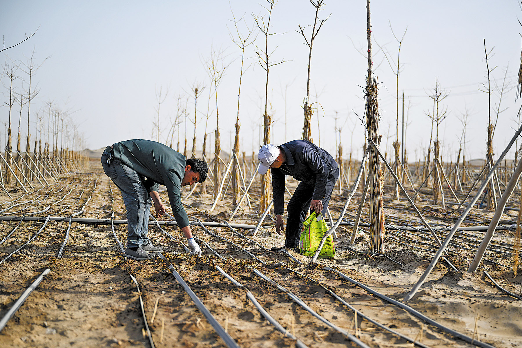
In 1952, researchers planted Mongolian pine in Zhangwu county, Liaoning province, to control wind and sand. Only a few of the first pines survived. Beyond survival rates, some trees showed degradation and death after growth, threatening the artificial forest's long-term stability.
"When a tree dies, we replant in that position, transforming the original single-layer, same-age forest into a multiage, multilayer forest," said Chen Peng, director of the afforestation division of the Shenyang Natural Resources Bureau in Liaoning. "With different forest layers, we now have a near-natural environment."
By mixing conifers with broadleaf trees and creating varying height levels with trees and shrubs, the artificial forest closely resembles a natural formation, with stronger abilities to control sand and resist pests, he said.
Chen's area falls within the Horqin and Hunshandake sandy lands — a typical agricultural-pastoral transition zone and the natural wind-sand source closest to the Beijing-Tianjin-Hebei region.
Su Yao, deputy director of Zhangwu county forestry and grassland bureau, said their work has diversified over the years. "Mongolian pine itself has relatively low timber value and a very long harvesting cycle. So to expand the economic benefits we grafted Korean pine onto Mongolian pine," Su said. After grafting, the economic benefits from pine cones increase five to tenfold, as pine nuts from Korean pine cones are popular consumer products.
Just as dead trees cannot resist wind and sand, if tree planting generates no economic benefits for planters, it's difficult to sustain long-term participation. Zhangwu county is trying various methods to increase growers' economic returns, such as interplanting medicinal herbs and economic crops among trees — an approach that has become widely recognized and promoted.
China's understanding of ecological environments has evolved, with the Three-North program developing from the initial "simple afforestation" to coordinated management of mountains, waterways, forests, fields, lakes, grasslands and deserts as an integrated system. In 2023, the State Council, China's Cabinet, released the white paper entitled China's Green Development in the New Era, which proposed that "adhering to green development is an all-around, revolutionary transformation of production methods, lifestyles, ways of thinking and values".
Systemic concept
The Yellow River "ji-shaped bend" region serves as both a major source area and pathway for sandstorms affecting Beijing, Tianjin and eastern regions, and is the main sediment source for the Yellow River's middle and lower reaches. This region forms an important component of the Three-North program as it features mountains, waterways, forests, fields, lakes, grasslands and deserts.
This area encompasses three major deserts — Kubuqi, Ulan Buh and Tengger — along with the Mu Us sandy land and over 10,000 sq km of loess plateau hilly and gully regions.
The Yellow River flows through this area, forming the shape of the Chinese character ji. The region faces unique ecological challenges, with both rivers and deserts, and particularly severe soil erosion problems.
For different areas in the Yellow River's various reaches, with their distinct landforms, natural endowments and territorial functions, local authorities have implemented areaspecific approaches. In the upper reaches, which feature hilly and gully terrain called "kongdui", they adopt a model of "planting trees on mountaintops, returning farmland to grass on slopes, building terraced fields on hillsides, and constructing dams in gully bottoms for land accretion".
In treating the Yellow River's downstream alluvial plains, salt-tolerant tamarisks take root first near water sources. At sand dune foundations, drought-resistant willows anchor shifting sands, while on dune tops, desert willows are woven into flexible grids to "shape" the dunes.
"Ten Major Kongdui" refers to 10 seasonal flash flood gullies on the Yellow River's southern bank in Inner Mongolia, located in Dalad Banner of Ordos city. These gullies transport sediment to the Yellow River year-round, causing soil erosion.
Yang Jianlong, head of the Dalad Banner forestry and grassland development center office, said there has been a scientific approach to tackling this issue.
"The management concept for the entire Heilaigou Kongdui follows the comprehensive governance approach of mountains, waterways, forests, fields, lakes, grasslands and deserts," Yang said.
"In terms of sediment transport, we previously delivered 27 million cubic meters annually to the Yellow River through the 10 Major Kongdui; now it's 4 million," he added.
President Xi's ecological philosophy emphasizes systematic approaches.
If tree planters only focus on planting trees, water managers only on managing water, and field protectors solely on protecting fields, it's easy to address one issue at the expense of another, ultimately causing systemic ecological damage, Xi said back in 2013.
During the 2021 National People's Congress, when discussing with the Inner Mongolia delegation, Xi further included the treatment of sand into the overall, systematic ecological governance.
ALSO READ: Mosaic of magic
Viewing mountains, waterways, forests, fields, lakes, grasslands and deserts as a life community represents China's latest concept for comprehensive, all-regional and full-process systematic ecological governance.
The Three-North program's success depends on systematic organization and implementation — from national top-down design and financial support, to local government implementation, to scientific research breakthroughs, to continuous public investment.
The Three-North program's core achievement lies in deeply integrating ecological, economic and social development goals. As it achieves the ecological objectives of preventing wind erosion, conserving soil and water, and improving climate, it will also transform "lucid waters and lush mountains" into economic assets through economic forests, understory economies and eco-tourism. This allows people to benefit from desertification control while protecting farmland, villages and transportation networks, ensuring livelihood safety and providing employment opportunities.
This model of "promoting development through governance and safeguarding governance through development" fundamentally resolves ecological engineering's sustainability challenges, forming a socio-ecological system full of endogenous vitality and self-evolution.
Contact the writer at zhangxiao@chinadaily.com.cn