
Hong Kong has suspended classes, grounded hundreds of flights and deployed additional manpower and equipment to minimize any risks to life and property damage as Super Typhoon Ragasa moves closer to the city.
The Hong Kong Observatory (HKO) hoisted typhoon signal No 1 at 12:20 pm on Monday and will raise it to No 3 at 9:40 pm. It has also warned that Ragasa poses a considerable threat to the coast of Guangdong; as it comes closer, the weather will deteriorate rapidly.
The observatory said it expects to issue the No 8 signal between 1 pm and 4 pm on Tuesday, and has warned residents to take all necessary precautions against high winds and severe flooding in advance of the deteriorating weather conditions.
READ MORE: China activates emergency response to Typhoon Ragasa in 3 provinces
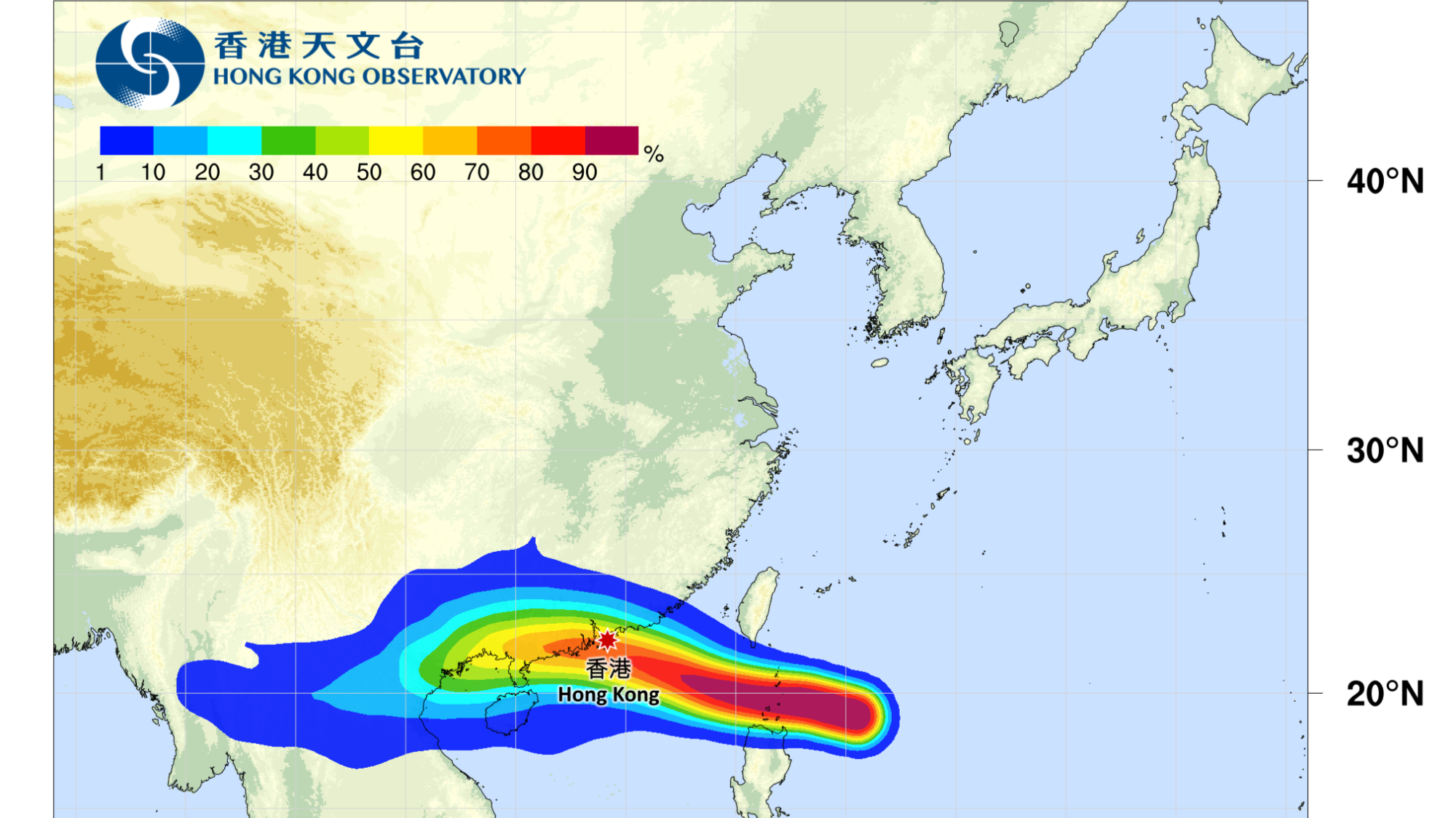
As of 2 pm of Monday, Ragasa was estimated to be about 840 kilometers east-southeast of Hong Kong. It is forecast to move west or west-northwest at about 22 km per hour across the Luzon Strait and enter the northern part of the South China Sea, the observatory said in a weather advisory.
“Under the influence of the extensive circulation of Ragasa, the weather over the coastal areas (of Guangdong) will deteriorate rapidly with winds strengthening significantly later tomorrow (Tuesday),” the city’s weather forecaster warned.
"The weather will be persistently adverse on Wednesday. Gale to storm force winds will prevail locally, and winds may reach hurricane force offshore and on high ground," the HKO pointed out, adding that there will be frequent heavy squally showers and thunderstorms while seas will be very high with swells.
Under the influence of significant storm surges, sea levels over coastal areas may be similar to those caused by super typhoons Hato and Mangkhut in 2017 and 2018, respectively, the observatory said. Mangkhut caused the most severe storm surge in Hong Kong’s history, with at least 60,000 cases of fallen trees reported.
Winds will weaken gradually on Thursday, and showers will ease off in the latter part of this week with the departure of Ragasa, according to the observatory.
Preparation work
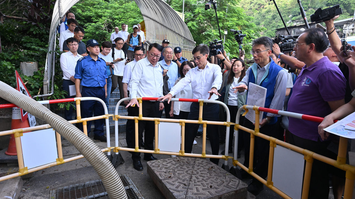
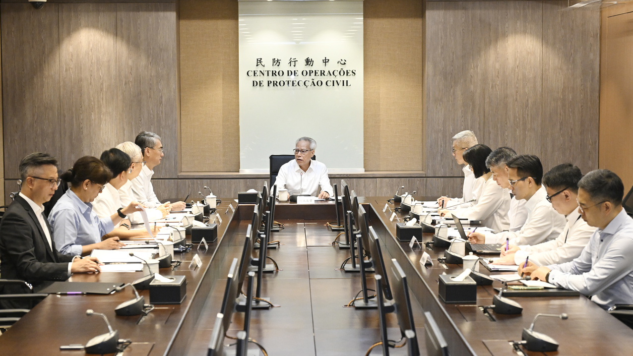
To prepare for the super typhoon, the city’s authorities have stepped up preparations and coordinated contingency measures to deal with severe flooding and landslides following a meeting of the steering committee on handling extreme weather, chaired by Chief Secretary for Administration Eric Chan Kwok-ki on Sunday.
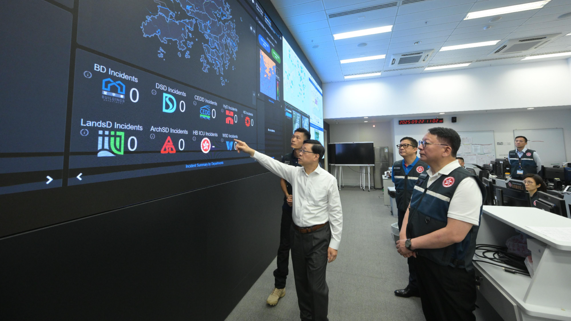
Hong Kong Chief Executive John Lee Ka-chiu directed the Security Bureau to activate the Emergency Monitoring and Support Centre on Monday morning to ensure advance preparations are in place.
He also chaired a meeting with Chan and Secretary for Security Chris Tang Ping-keung to review emergency response efforts across government departments.
Lee instructed heads of departments not to underestimate the potential impact of the typhoon and emphasized the need to take all necessary precautions.
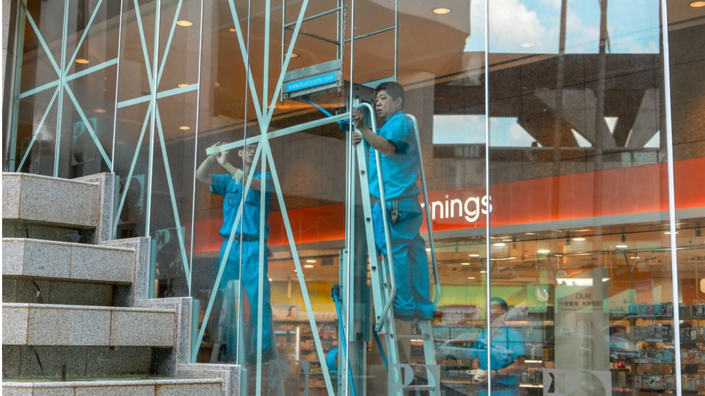
On Monday, Secretary for Culture, Sports and Tourism Rosanna Law Shuk-pui said the Leisure and Cultural Services Department has been inspecting public parks over the past three days to check the condition of trees, with remedial works being carried out, including reinforcing thinner trees and pruning plants with too many branches.
The Mass Transit Railway (MTR) Corp, which operates the city’s subway and rail services, said all subway and light rail services, including the Airport Express, will be suspended after the No 9 signal or above is hoisted. All subway stations will stay open during service hours if circumstances permit.
The Hong Kong International Airport (HKIA) will remain operational during the storm, but a substantial number of flights are expected to be grounded over the coming two days, the Airport Authority Hong Kong (AAHK) said.
At a news conference on Monday afternoon, Wing Yeung Tak-wing, director of service delivery of AAHK, said the airport would see a significant reduction in the number of flight take-offs and landings after 6 pm on Tuesday, with few if any flights on Wednesday, and reminded passengers to check their flight status with airlines before departing for the airport.
Over 500 Cathay Pacific Airways flights will be affected during the storm as the carrier has decided to suspend all inbound and outbound passenger flight operations after 6 pm on Tuesday, with services expected to resume on Thursday.
Hong Kong Express Airways has scheduled four flights for early departure on Tuesday, but more than 100 of its flights will be canceled over the coming few days.
Hong Kong Airlines said it has canceled flights from 6 pm on Tuesday until 6 am on Thursday and will continue to announce timely operational updates as the situation develops.
Greater Bay Area Airlines has delayed or canceled flights scheduled for after 6 pm on Tuesday and all of Wednesday.
Flexible ticket cancellation policies are provided by the airlines.
Over 1,000 staff from the AAHK, various government departments, airlines and service contractors, will be deployed at the airport throughout the severe weather conditions to provide services.
The authority will set up temporary rest areas in the building's transitional levels, providing chairs, mobile phone charging stations, and essential supplies for stranded passengers. Some eateries in the passenger terminal will stay open around the clock during the storm.
As public transportation to and from the airport will cease operations after the signal No 9 or above has been hoisted, the AAHK will activate the Queue Ticket System for taxis following the issuance of the No 8 storm signal. The system enables passengers to receive a queue number from ticket kiosks or via mobile application to avoid having to wait in line for a taxi.
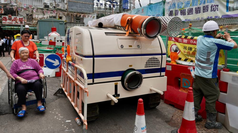
At a joint conference on Tuesday, Director of Drainage Services Ringo Mok Wing-cheong said that the authority has increased the total number of emergency response teams to 200 to conduct inspections and clearance of drainage channels across the territory.
Four previously ordered pumping robots — known as “water-pumping dragons” — are expected to arrive in Hong Kong no later than Tuesday morning, and will be put into operation immediately.
The Education Bureau (EDB) announced that classes at all day schools, including secondary schools, primary schools, special schools, kindergartens, kindergarten-cum-child-care centers, and evening schools are suspended on Tuesday and Wednesday.
During the class suspension period, schools will not accept paper applications for discretionary places under the Primary One Admission 2026. The deadline for submitting paper applications has been extended to Sept 30.
Non-emergency services at public hospitals — including services at general out-patient clinics, specialist out-patient clinics, allied health, geriatric day hospitals and psychiatric day hospitals, ambulatory services, non-emergency laboratory tests and diagnostic services — will be suspended when the signal No 8 warning or above is in force.
READ MORE: 'Super typhoon' fears for HK residents as Ragasa likely to intensify
All acute services at public hospitals — including services of accident and emergency departments, inpatient services and emergency surgeries — will remain as normal, the Hospital Authority (HA) said.
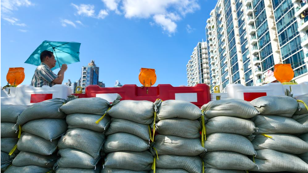
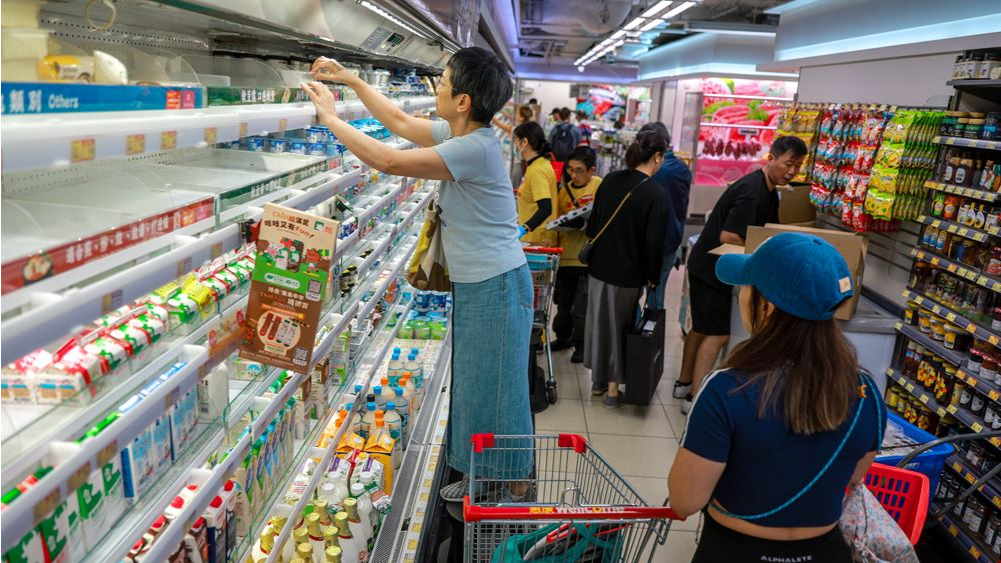
The authorities reminded the public to be prepared for ongoing severe weather conditions over the next two days, including implementing emergency, wind and flooding prevention measures. Residents in flood-prone areas and those staying in temporary structures such as rooftop houses and squatter huts near slopes should stay away from their homes or stay at temporary shelters. It is recommended that vehicles parked outdoors are moved to indoor parking spaces.
Neighboring cities have also taken emergency measures as Ragasa approaches.
The Macao Special Administrative Region said it will raise the No 1 signal on Monday afternoon. At an interdepartmental emergency response meeting, Chief Executive Sam Hou-fai said the SAR government has carried out comprehensive preparations and mobilized adequate manpower, and has vowed to spare no effort in ensuring the safety, orderliness and stability of the community.
Shenzhen’s Meteorological Bureau urged residents to stock up on at least three days of drinking water, food, medicine and emergency supplies. The city’s Emergency Management Bureau said it plans to relocate some 400,000 people from the coastal areas, low-lying regions and construction sheds across the city.
Jiangmen said it would progressively implement its “five stop” measures, covering the suspension of classes, work, production, transportation and businesses.
Contact the writers at atlasshao@chinadailyhk.com