
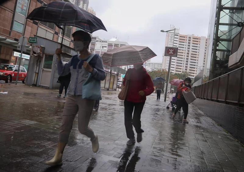
 People walk on the street in Tseung Kwan O amid rain on May 12, 2022. (CALVIN NG / CHINA DAILY)
HONG KONG – The Hong Kong Observatory issued the amber rainstorm warning signal on Thursday, as an active trough of low pressure is bringing unsettled weather to the coast of Guangdong.
Besides, a thunderstorm warning issued at 11:00 on Wednesday night also remains in force.
The observatory warned that intense gusts reaching 70 kilometers per hour or above may affect Hong Kong.
READ MORE: Level-IV emergency response activated in Pearl River basin
“There will be flooding in some low-lying and poorly drained areas. People who are likely to be affected should take necessary precautions to reduce their exposure to risk posed by the heavy rain and flooding,” reads an HKO bulletin issued at 12:10 pm.
People who are likely to be affected should take necessary precautions to reduce their exposure to risk posed by the heavy rain and flooding.
Hong Kong Observatory
The observatory first issued the amber rainstorm warning signal at 05:25 am and lifted it at 6:40 am. As hard rain kept on pouring in many parts of the city, the HKO reinstated the amber rainstorm warning signal at 12:10 pm.
The signal signifies that heavy rain has fallen or is expected to fall generally over Hong Kong, exceeding 30 millimeters in an hour, and is likely to continue.
Due to the thunderstorm warning, a flag-raising ceremony scheduled to be held at 8 am at the Golden Bauhinia Square in Wan Chai was canceled, according to a government press release.
Cautioning that heavy rain may bring about flash floods, the observatory advised people to stay away from watercourses. “People who are likely to be affected by flooding should take necessary precautions to avoid losses.”
Locally, more than 30 millimeters of rainfall were recorded over many places this morning, and rainfall even exceeded 70 millimeters over northern and eastern parts of the New Territories.
A few squally thunderstorms are expected to occur over Hong Kong, with moderate to fresh south to southwesterly winds.
The HKO said showers will be heavy at times and the maximum temperature will be around 28 degrees.
 This photo taken on May 12, 2022 morning at the Central Pier Automatic Weather Station looking towards the east shows a hazy sky as a downpour continues in Hong Kong. (PHOTO COURTESY OF HONG KONG OBSERVATORY)
Members of the public have been advised to seek safe shelter if they are staying outdoors and avoid standing on high grounds and highly conductive objects, trees or masts.
ALSO READ: First black rainstorm warning of 2021 disrupts life in HK
Forecasting occasional heavy showers and squally thunderstorms for Friday, the observatory said the weather will remain unsettled over the weekend with a surge of the northeast monsoon is expected to reach the coast of Guangdong on Sunday.
Temperatures will fall slightly to below 20 degrees early next week.
With the trough of low pressure departing the coastal areas, the weather will improve gradually early to midweek next week, the HKO added.